North America
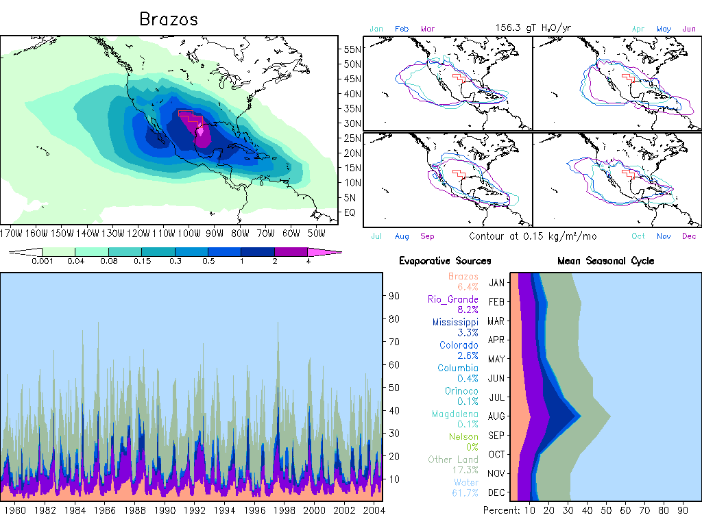
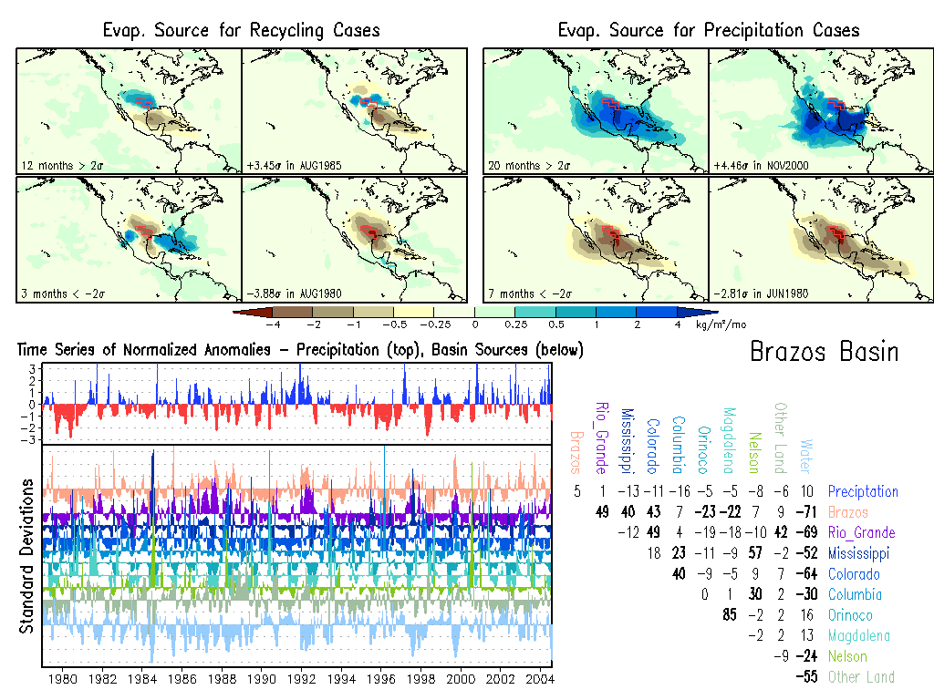
Brazos: Climate, Anomalies.
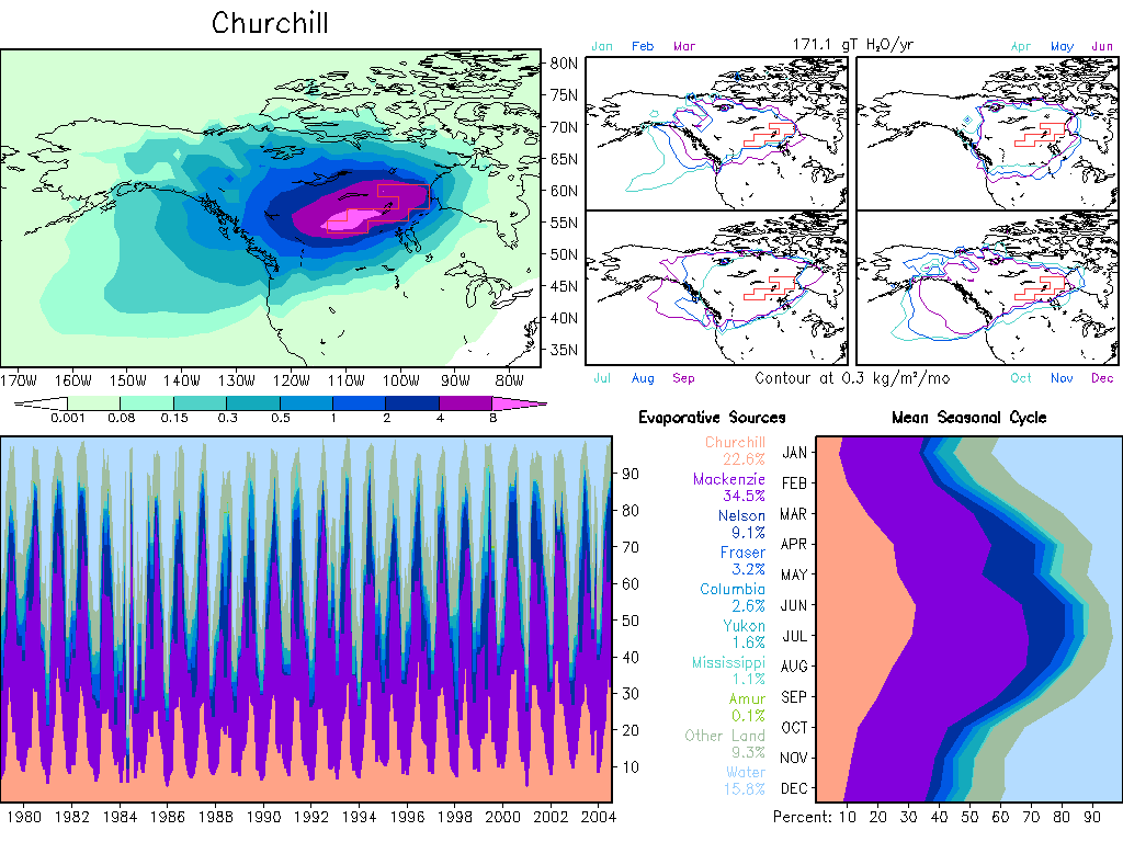
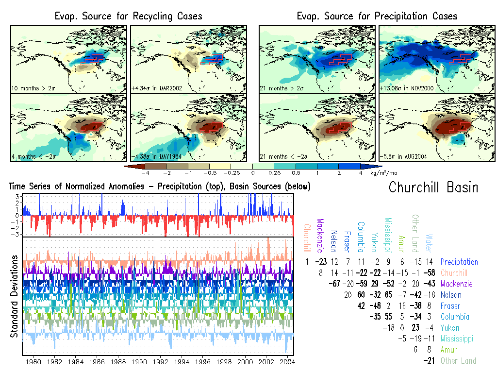
Churchill: Climate, Anomalies.
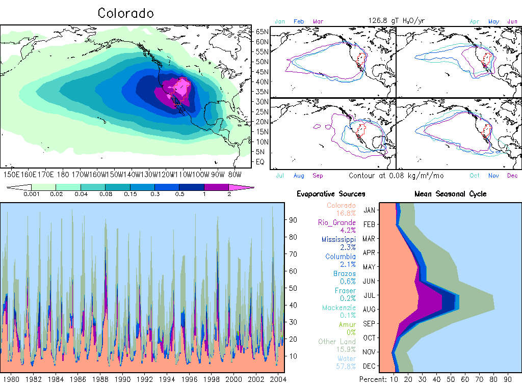
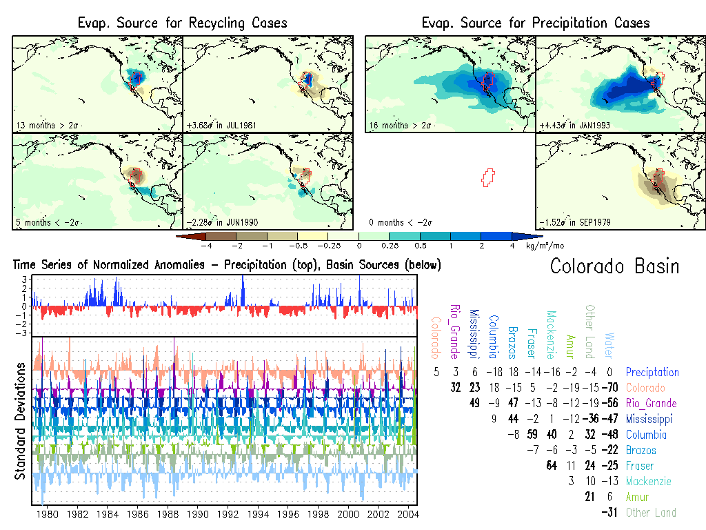
Colorado: Climate, Anomalies.
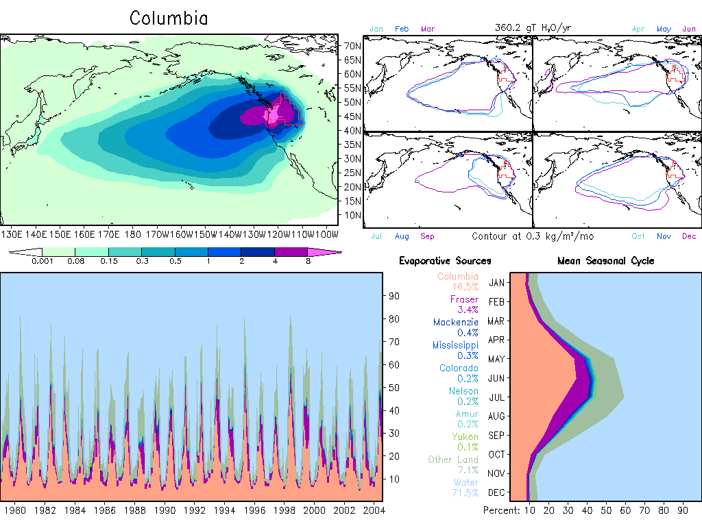
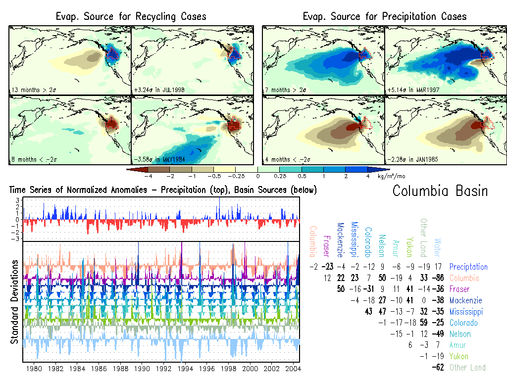
Columbia: Climate, Anomalies.
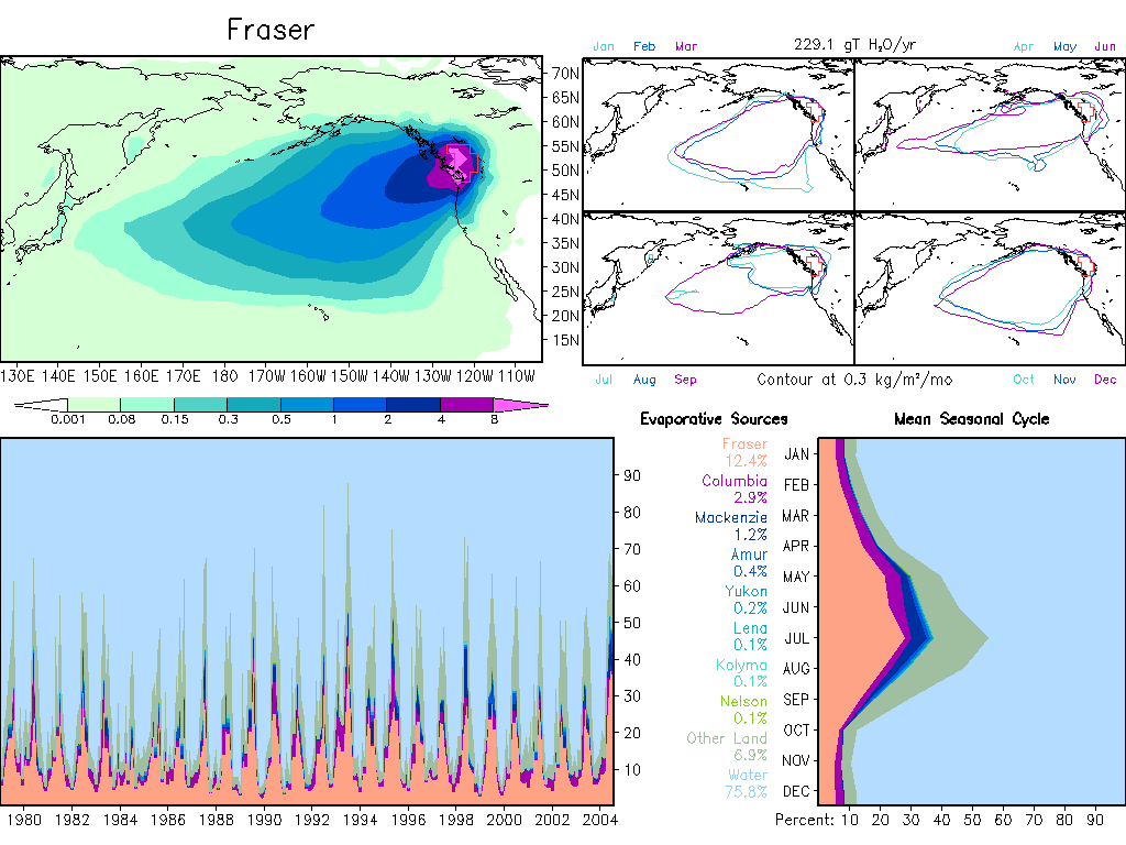
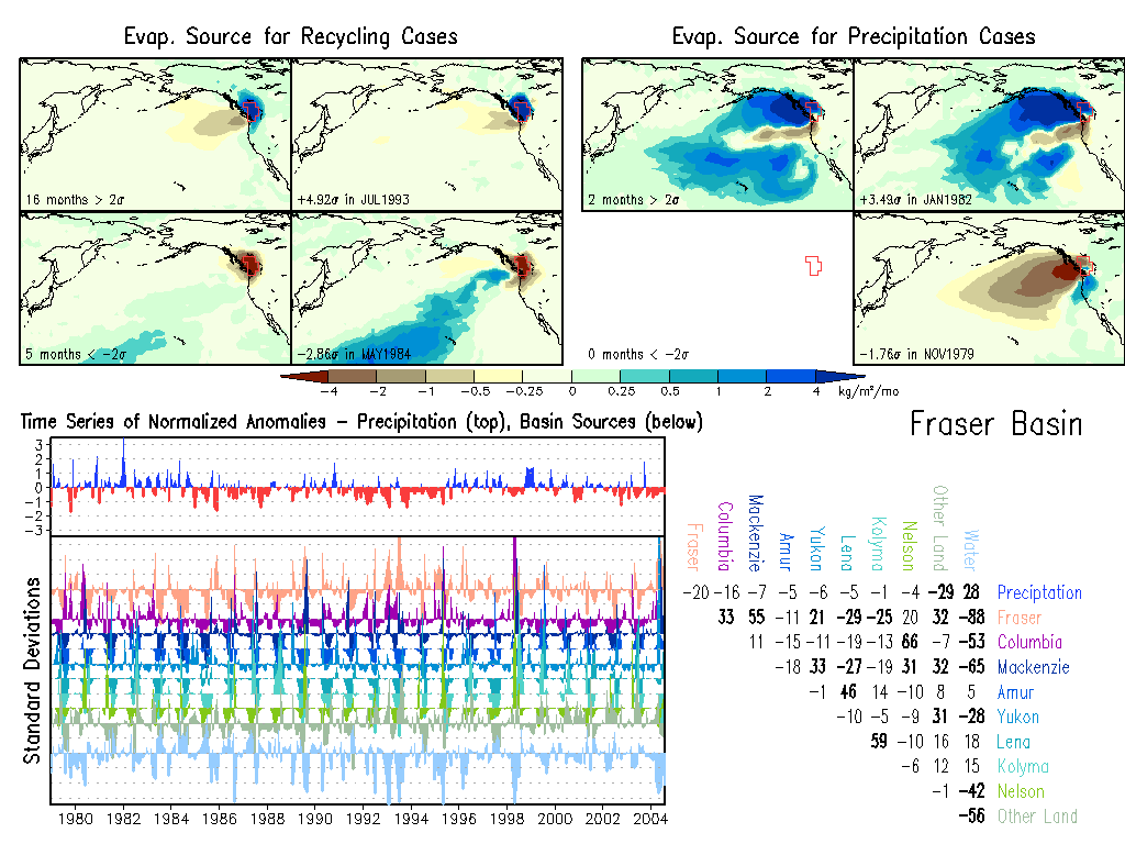
Fraser: Climate, Anomalies.
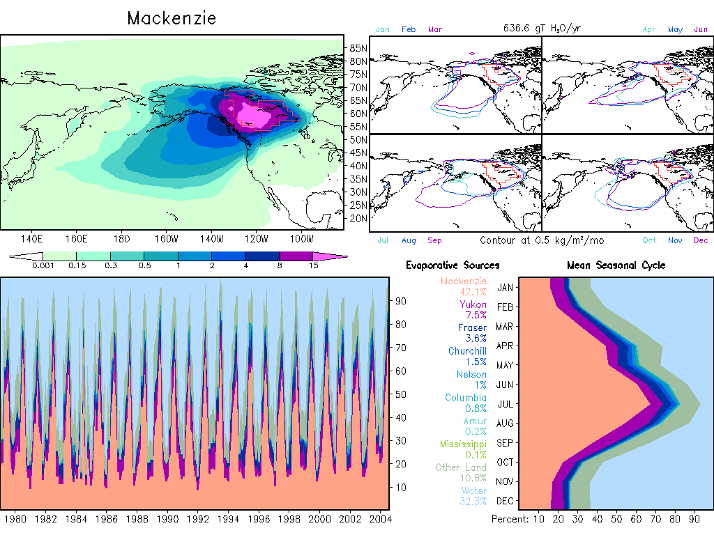
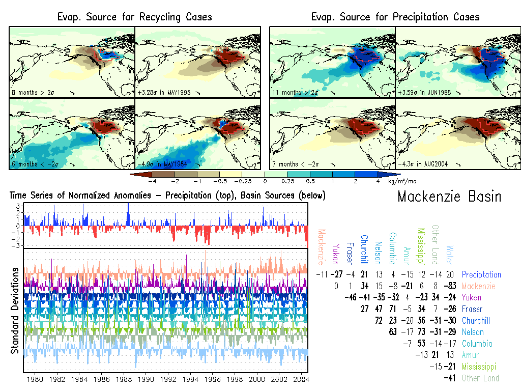
Mackenzie: Climate, Anomalies.
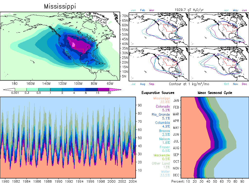
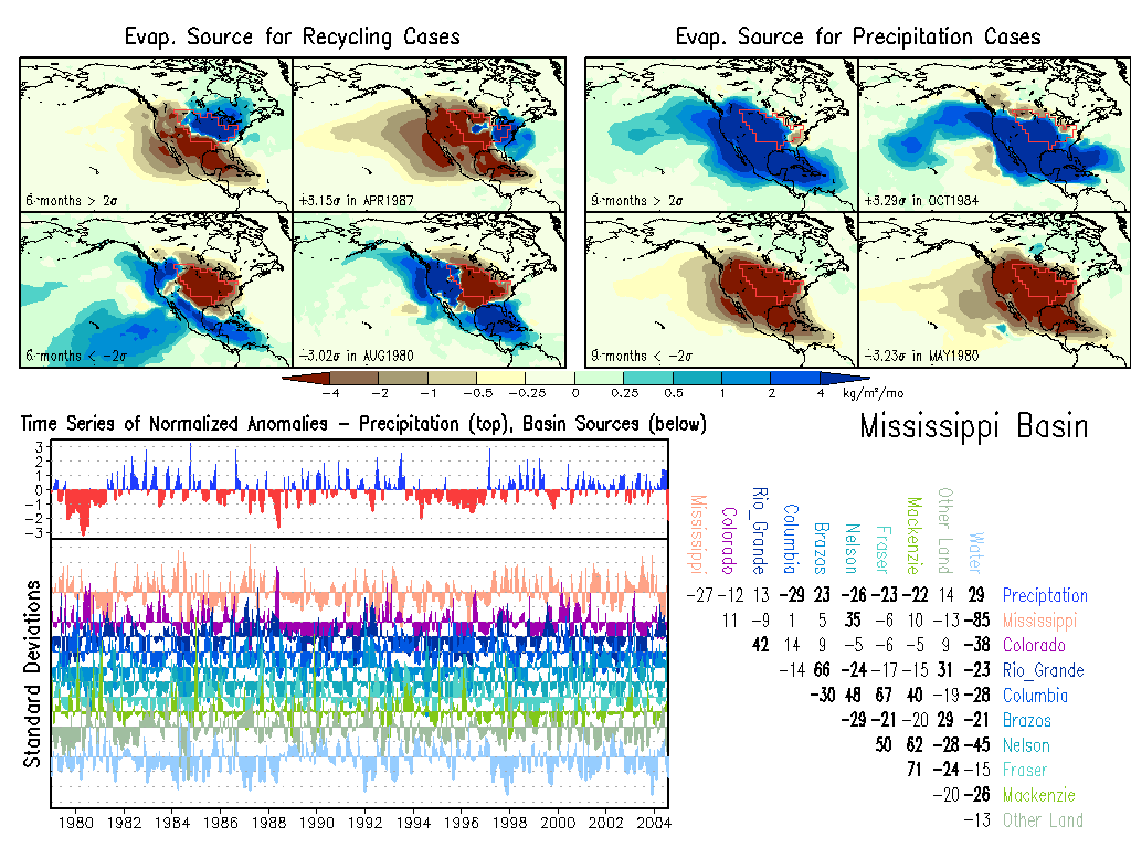
Mississippi: Climate, Anomalies.
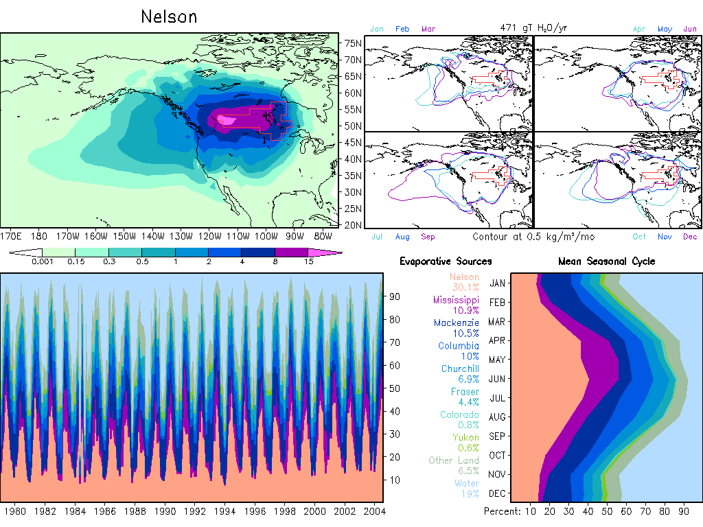
Nelson: Climate, Anomalies.
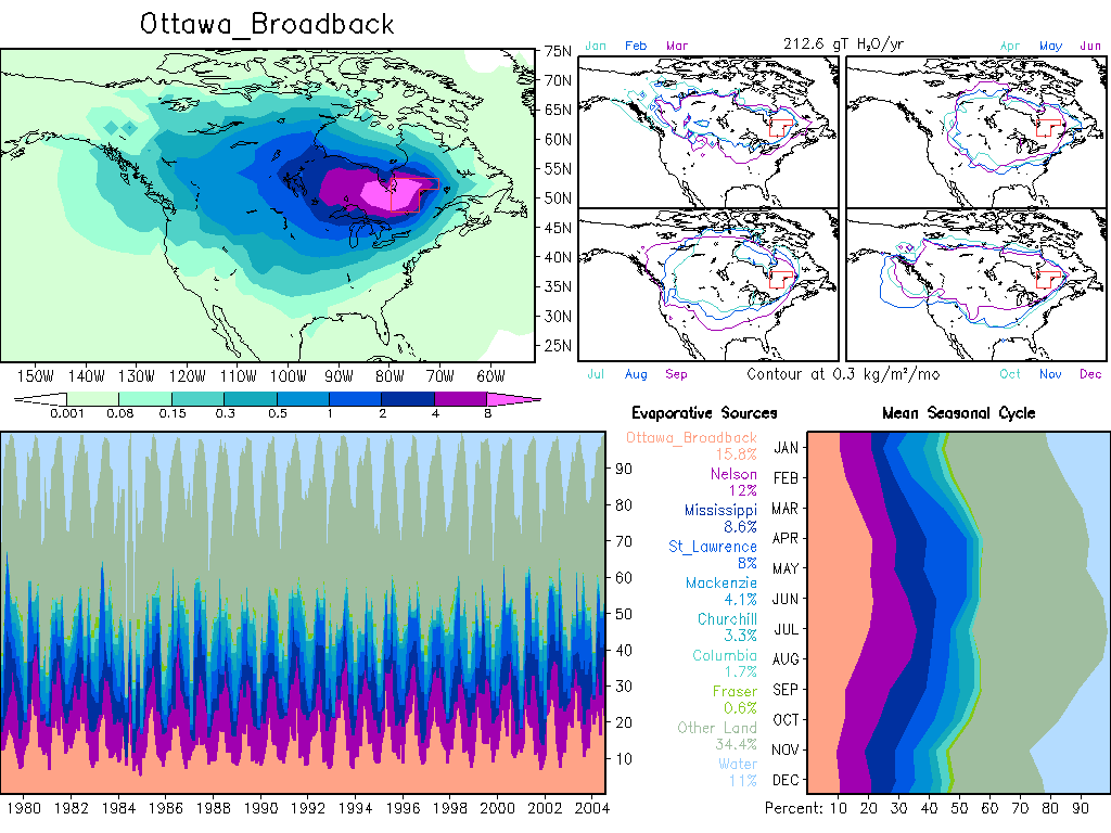
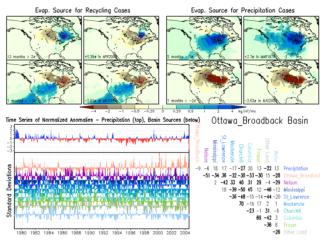
Ottawa_Broadback: Climate, Anomalies.
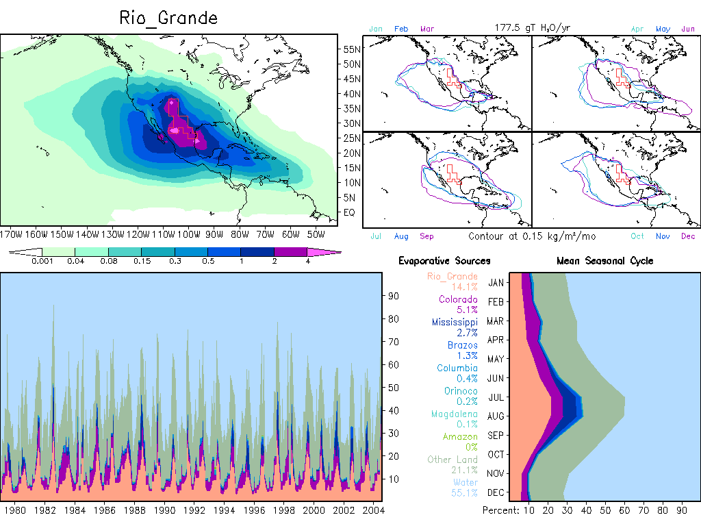
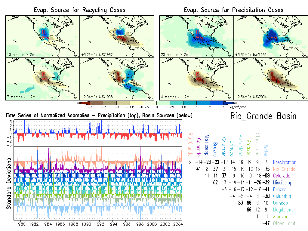
Rio_Grande: Climate, Anomalies.
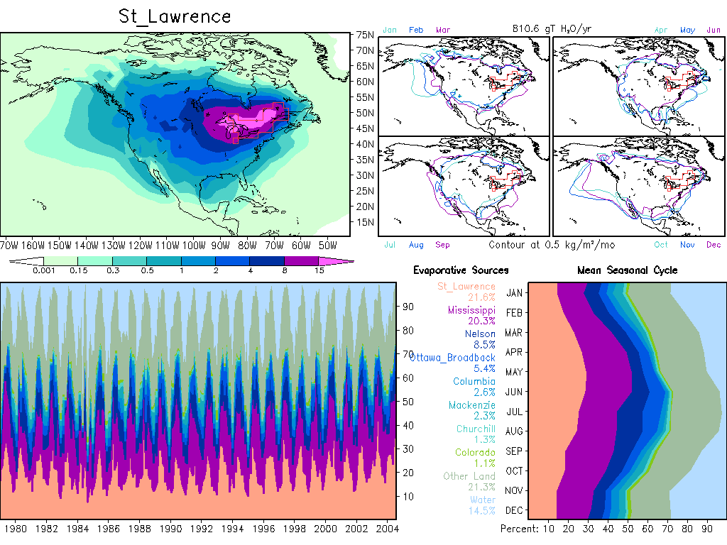
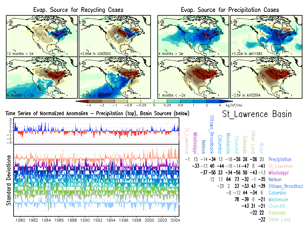
St_Lawrence: Climate, Anomalies.
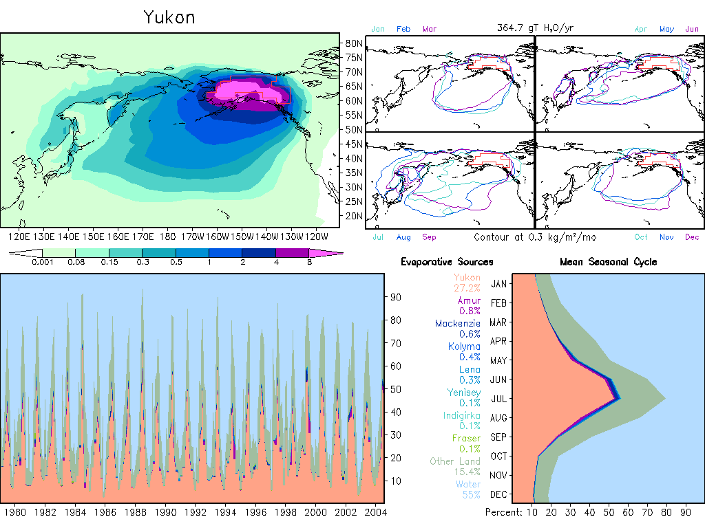
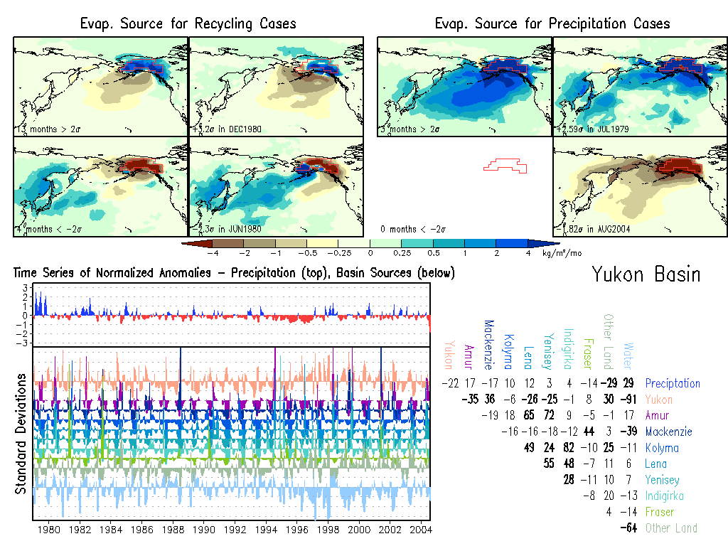
Yukon: Climate, Anomalies. |
|
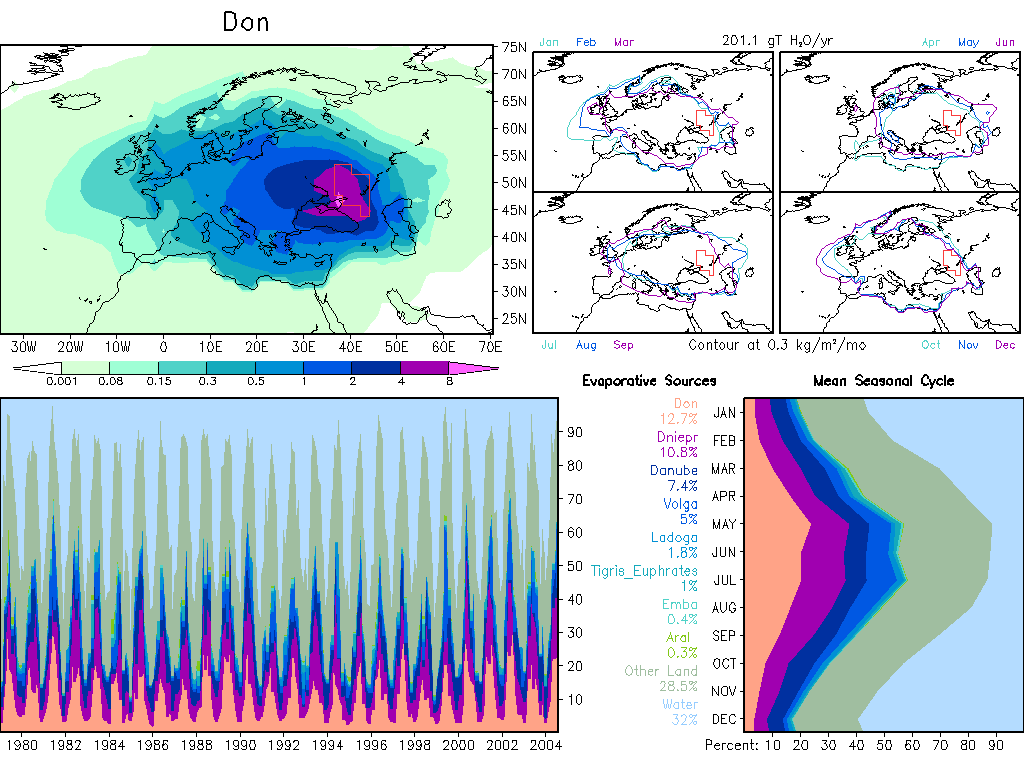
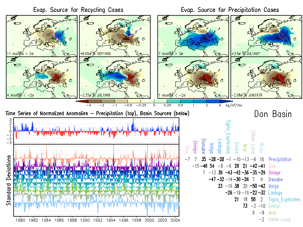
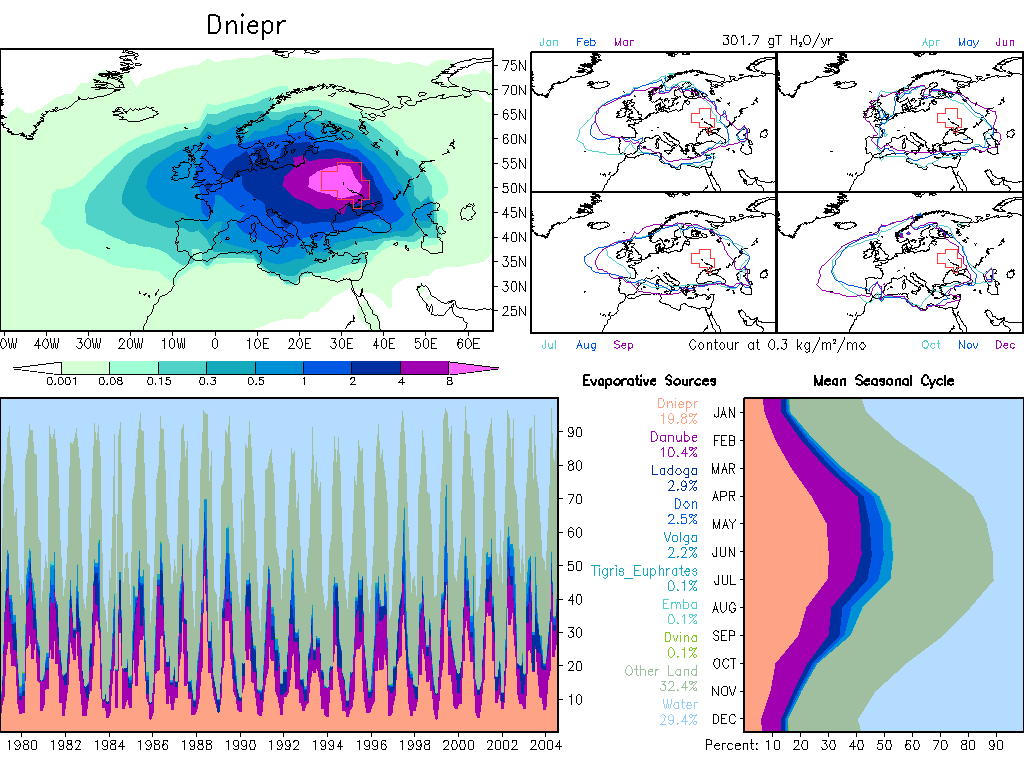
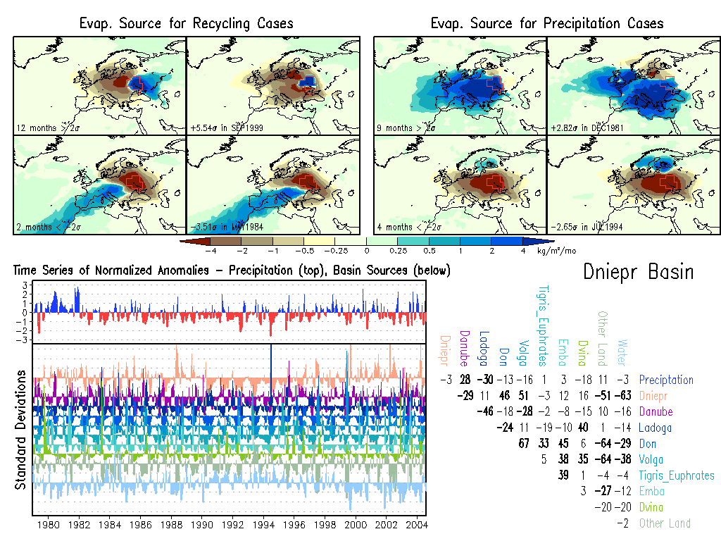
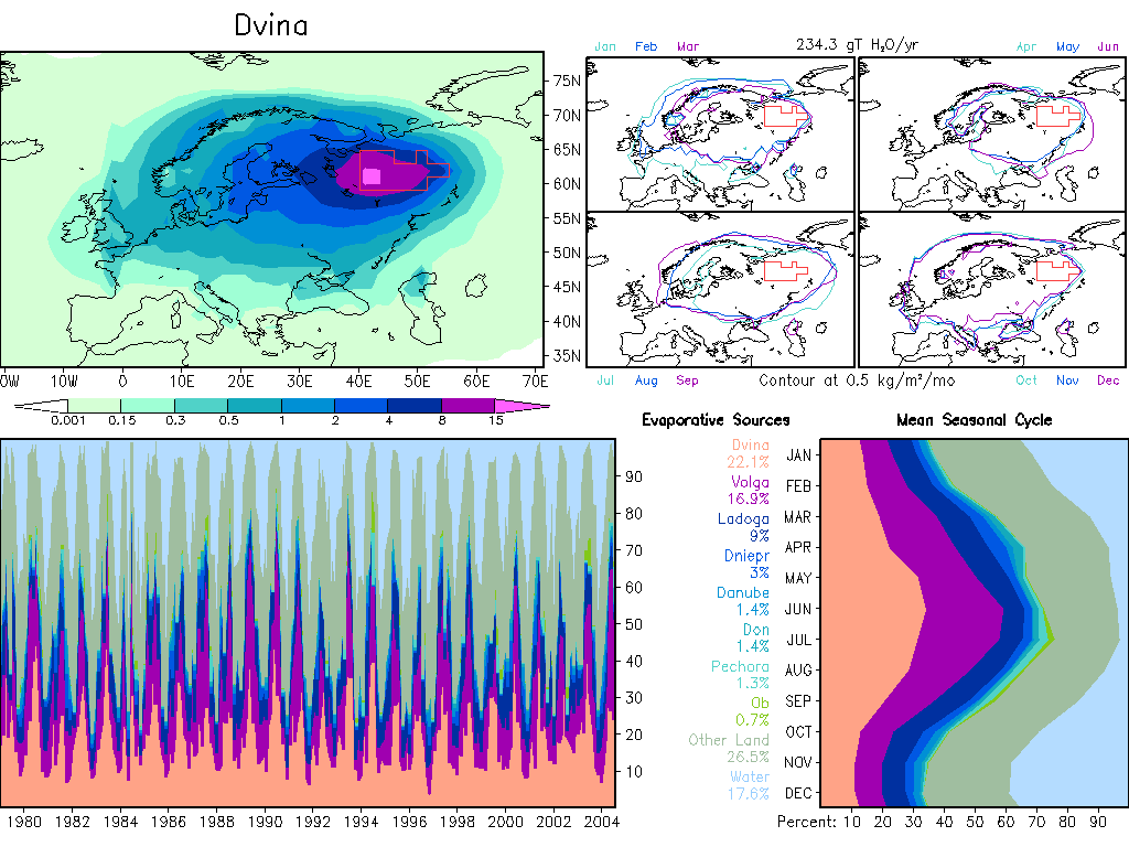
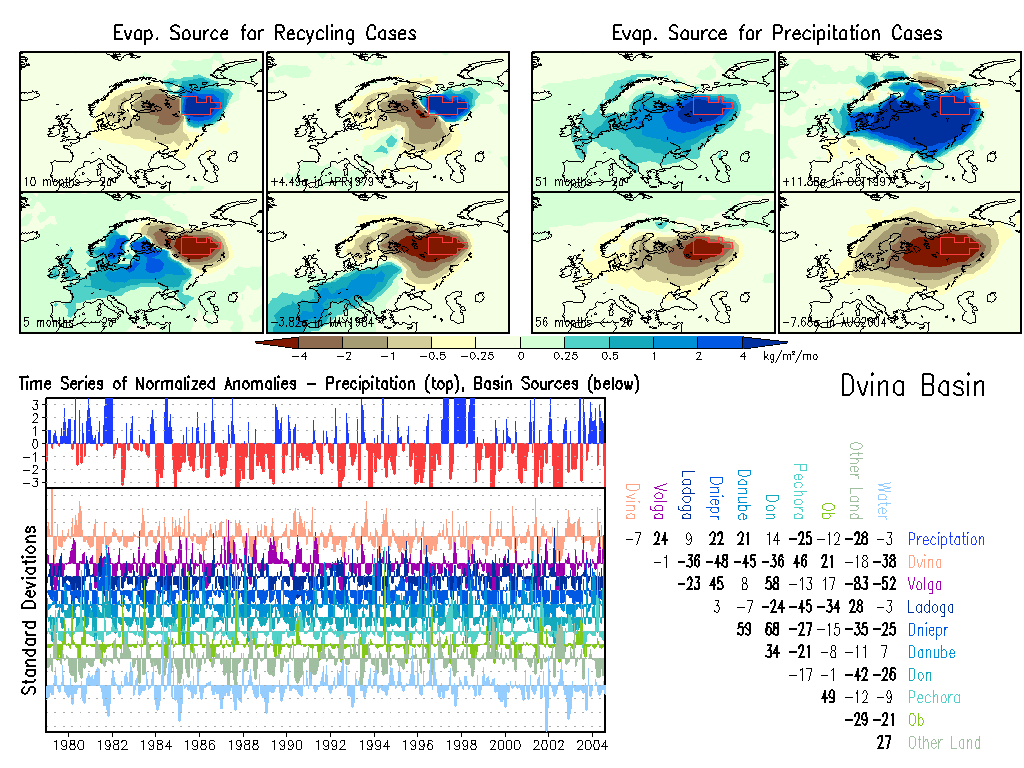
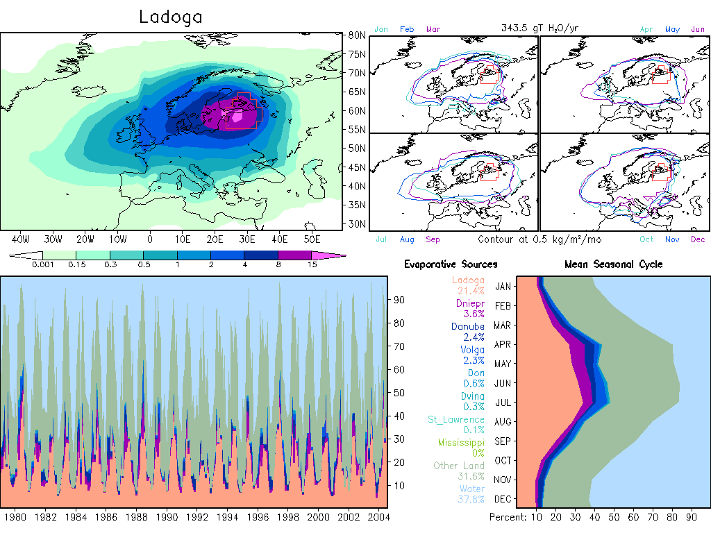
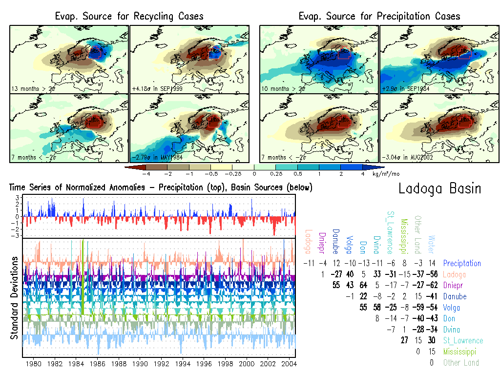
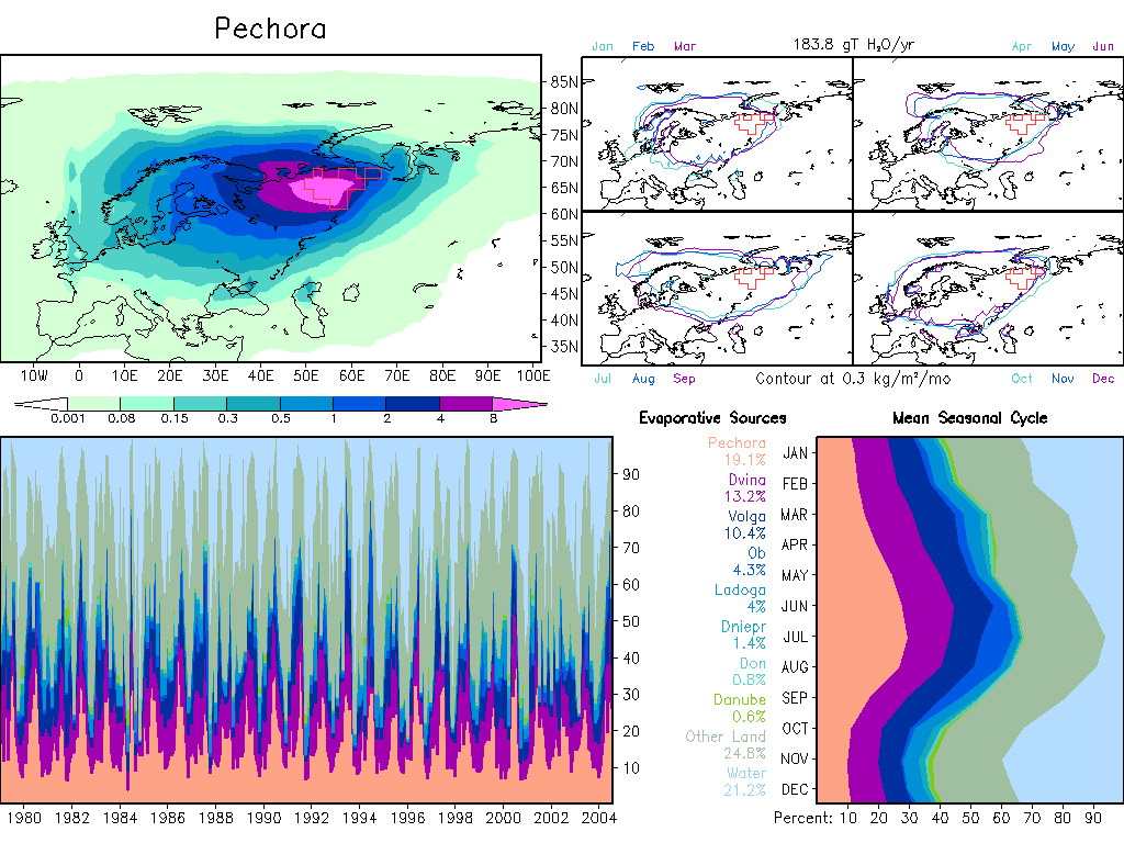
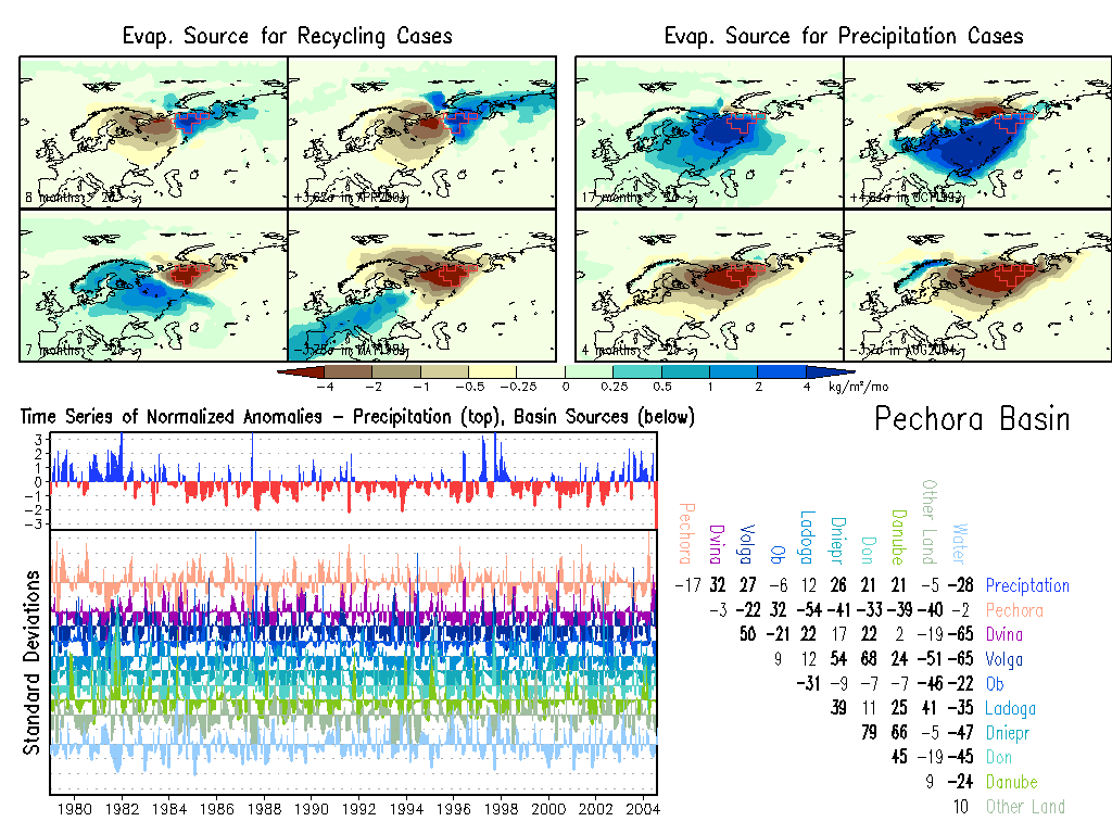
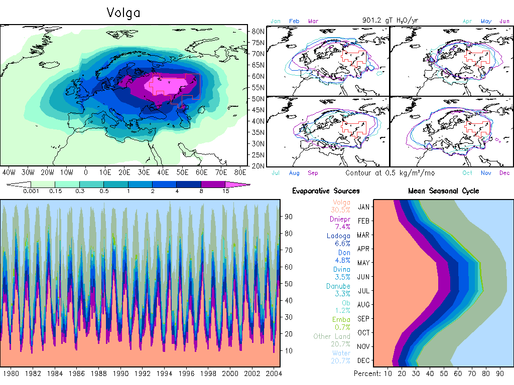
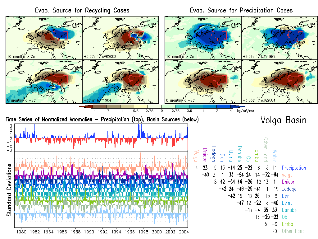
Europe
|
W.Asia
Aral: Climate, Anomalies.
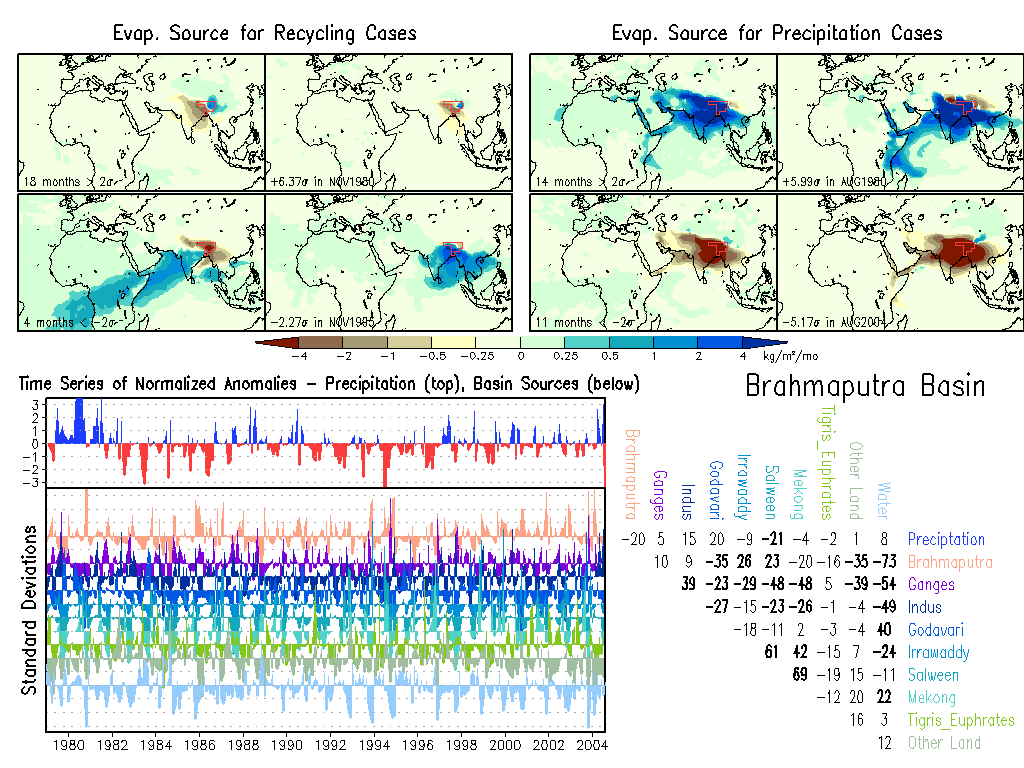
Brahmaputra: Climate, Anomalies.
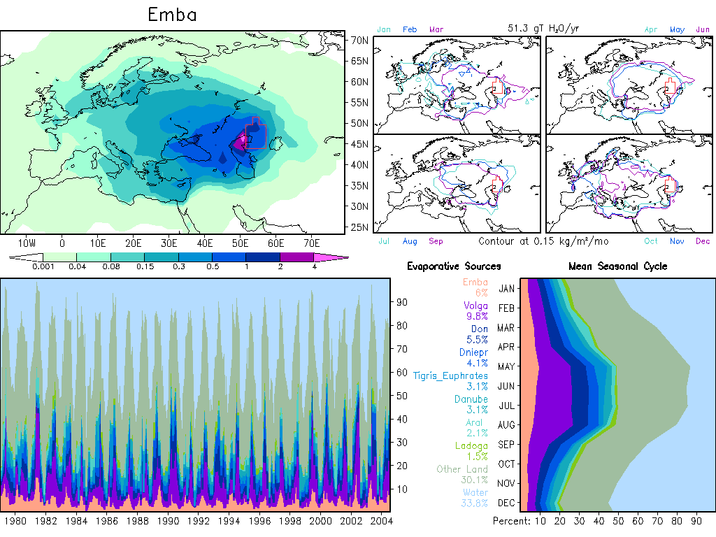
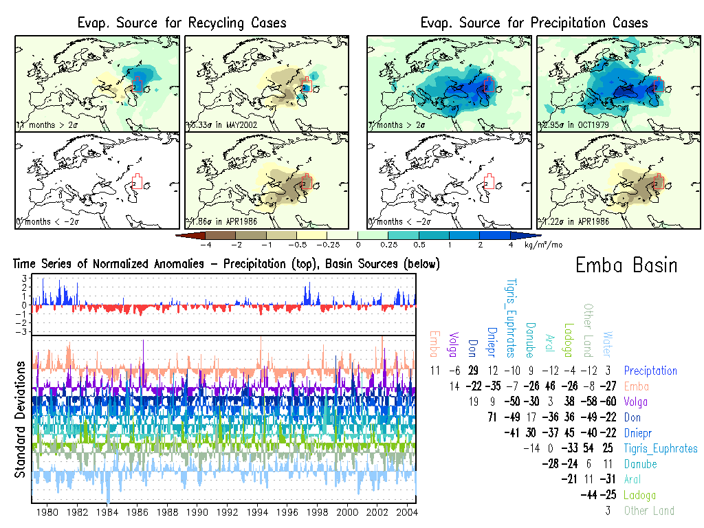
Emba: Climate, Anomalies.
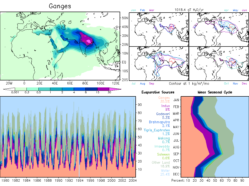
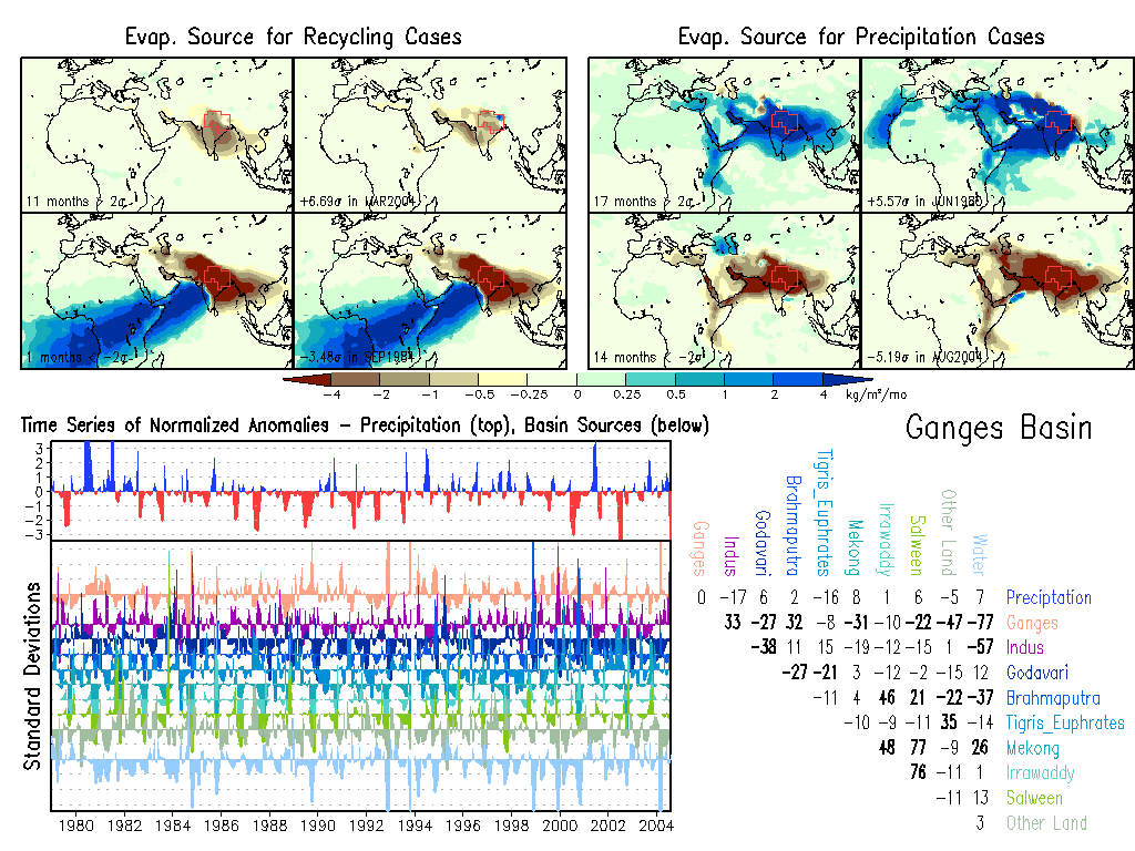
Ganges: Climate, Anomalies.
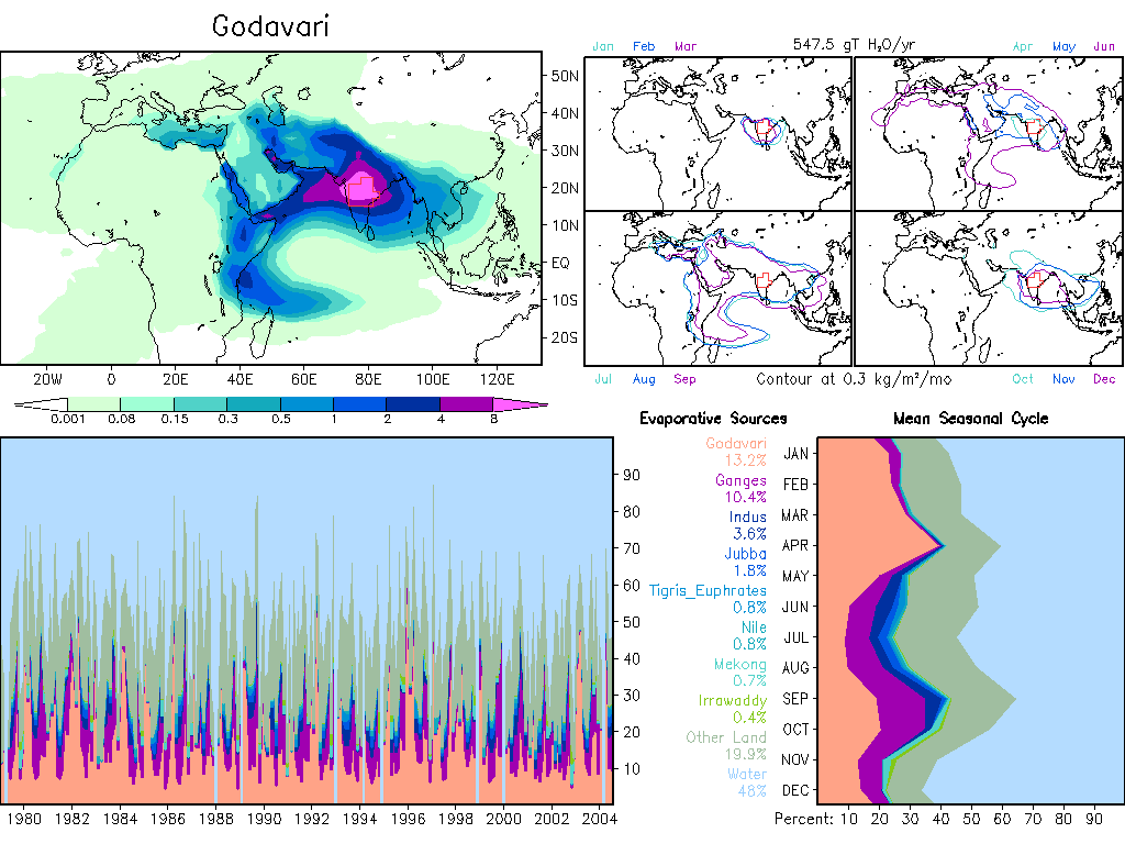
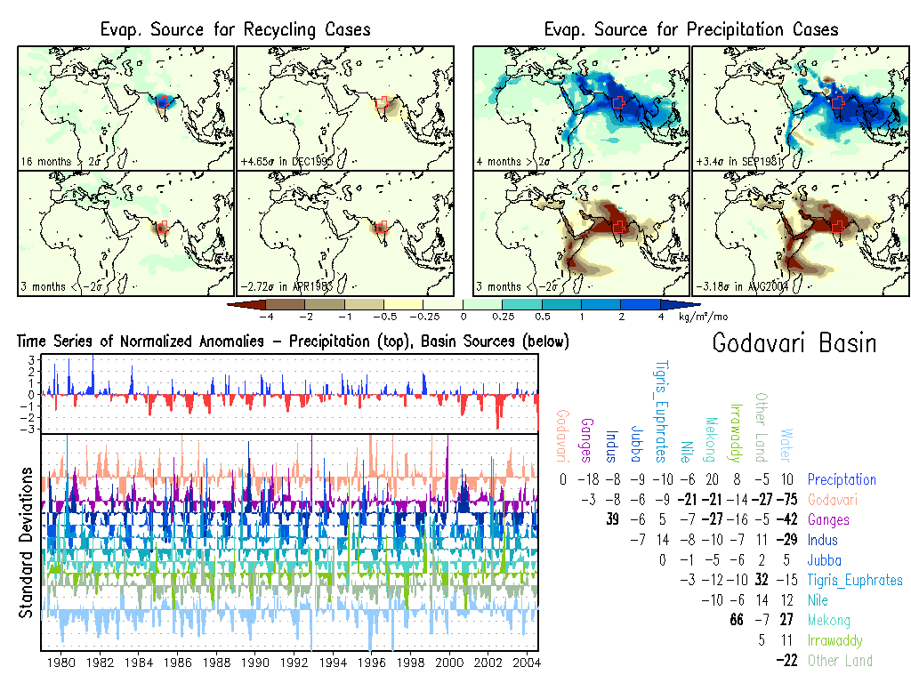
Godavari: Climate, Anomalies.
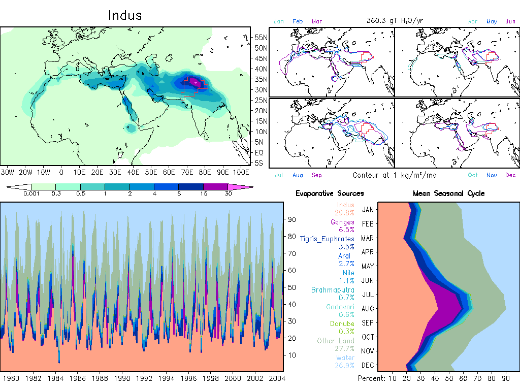
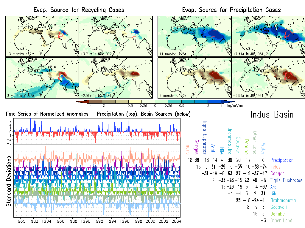
Indus: Climate, Anomalies.
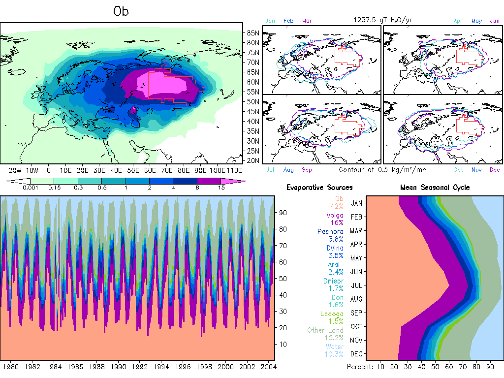
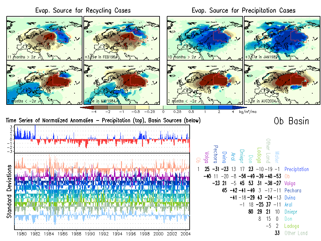
Ob: Climate, Anomalies.
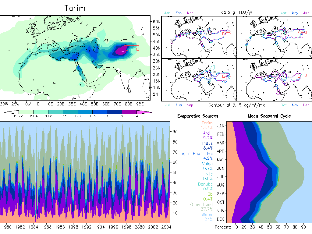
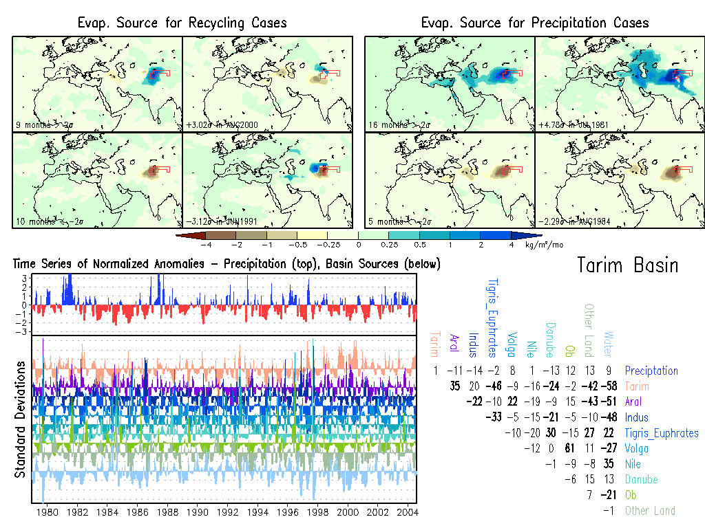
Tarim: Climate, Anomalies.
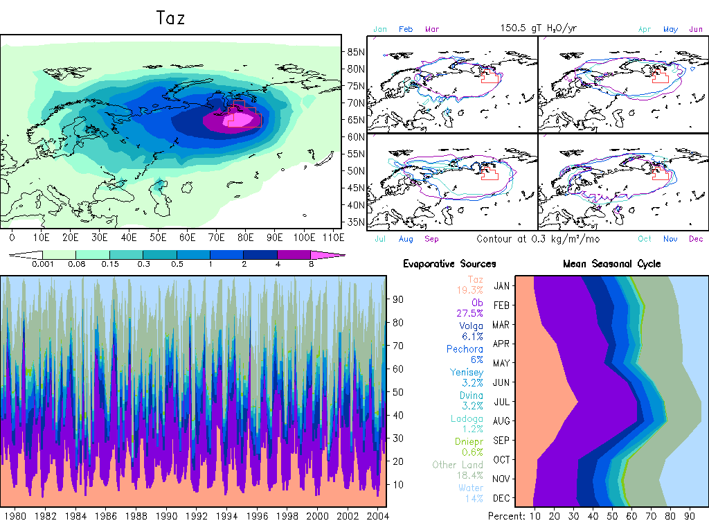
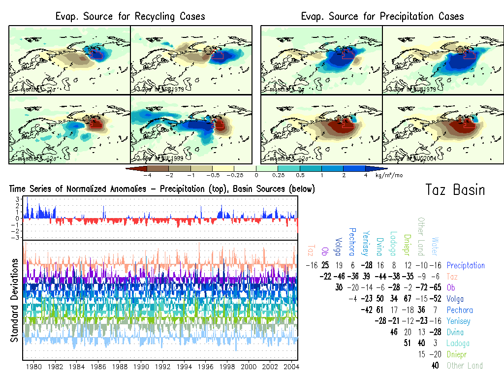
Taz: Climate, Anomalies.
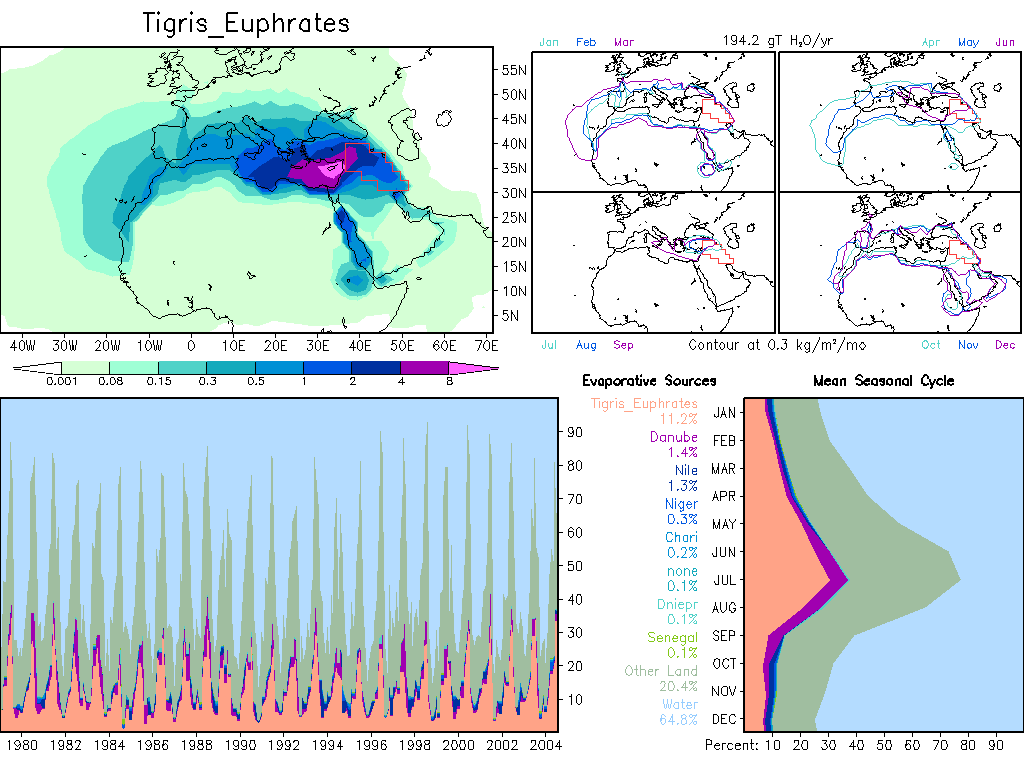
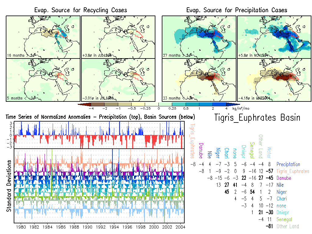
Tigris_Euphrates: Climate, Anomalies.
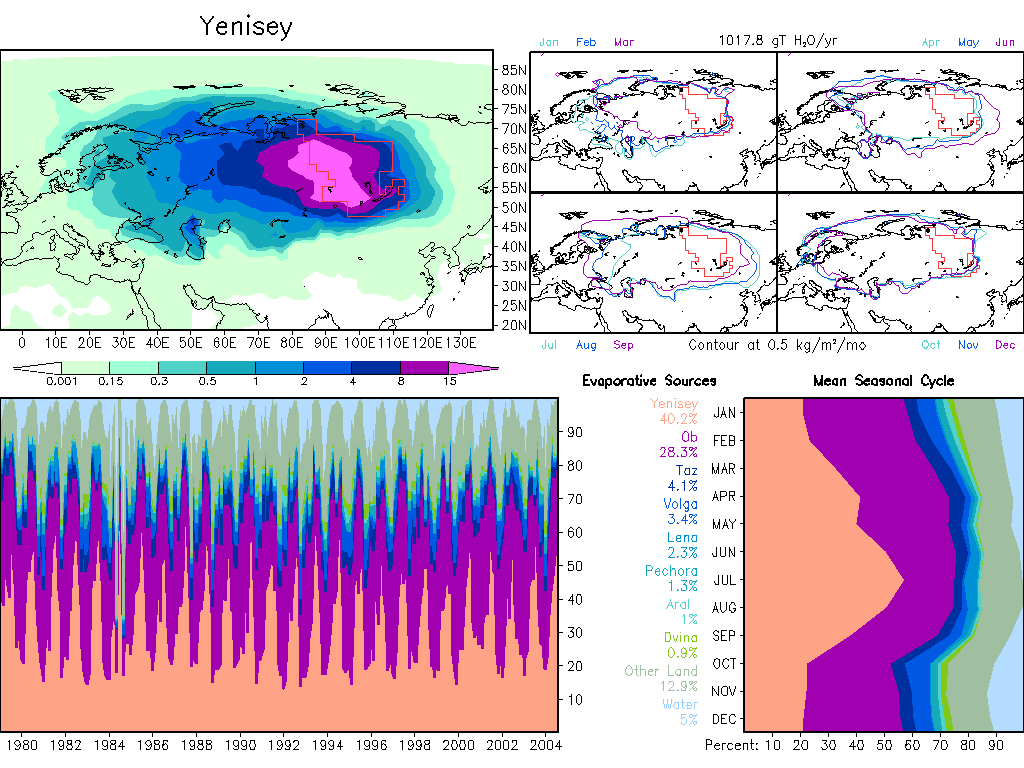
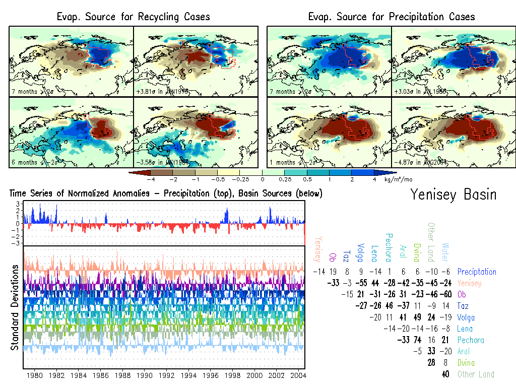
Yenisey: Climate, Anomalies. |
|
E. Asia & Oceania
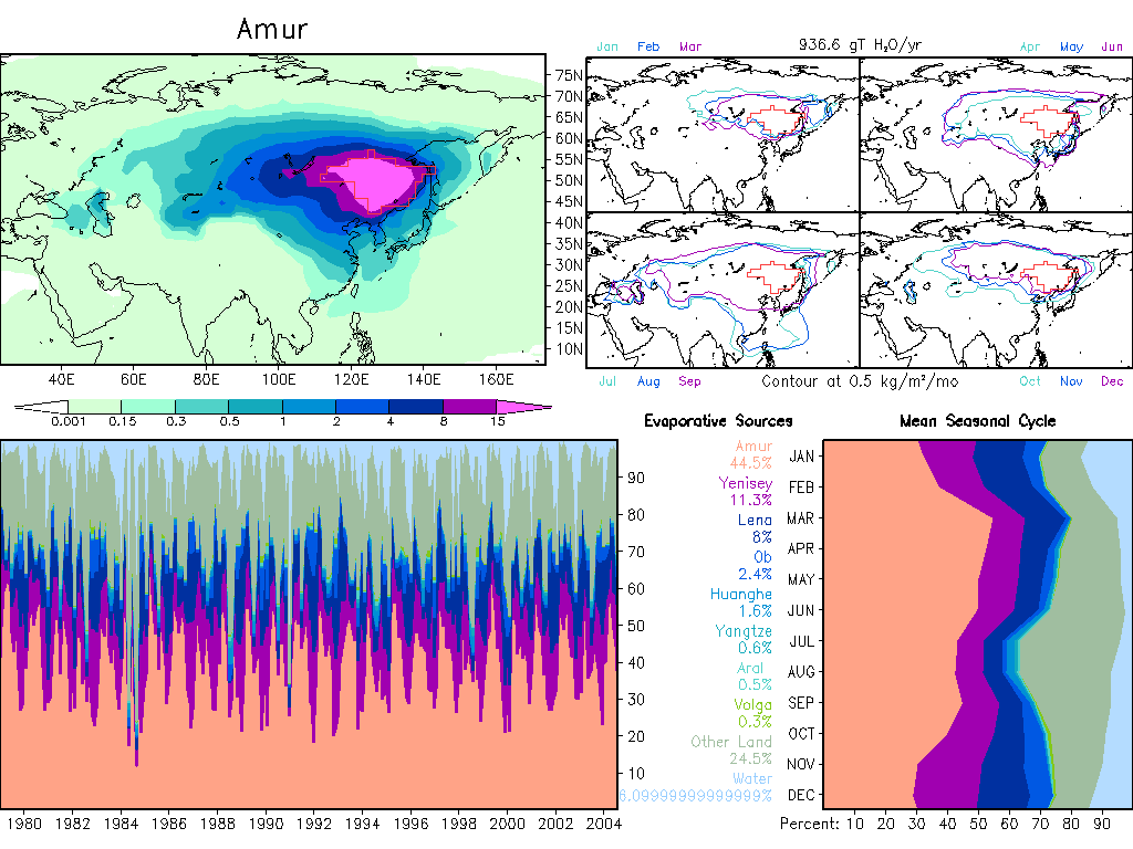
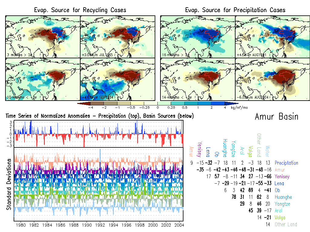
Amur: Climate, Anomalies.
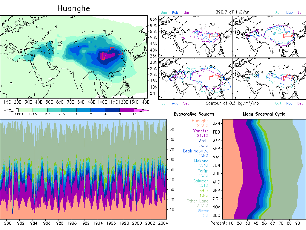
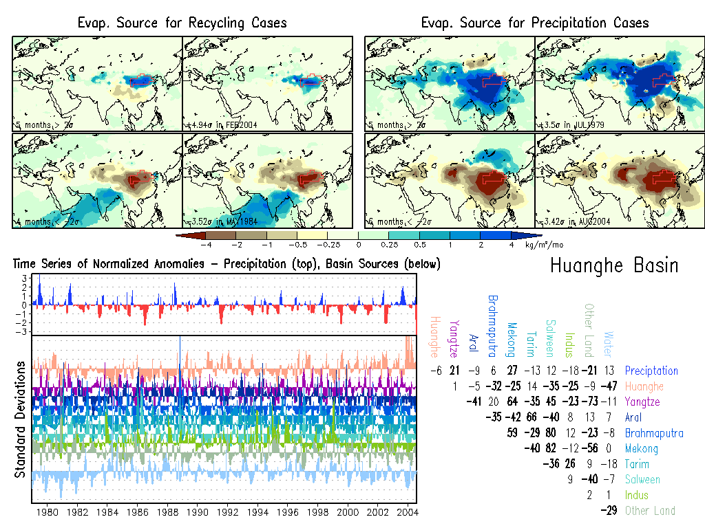
Huanghe: Climate, Anomalies.
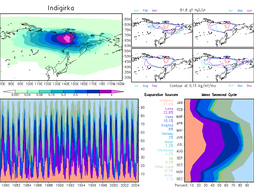
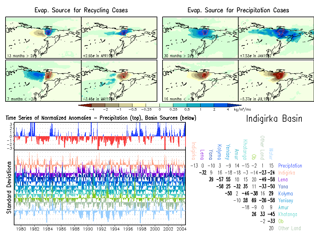
Indigirka: Climate, Anomalies.
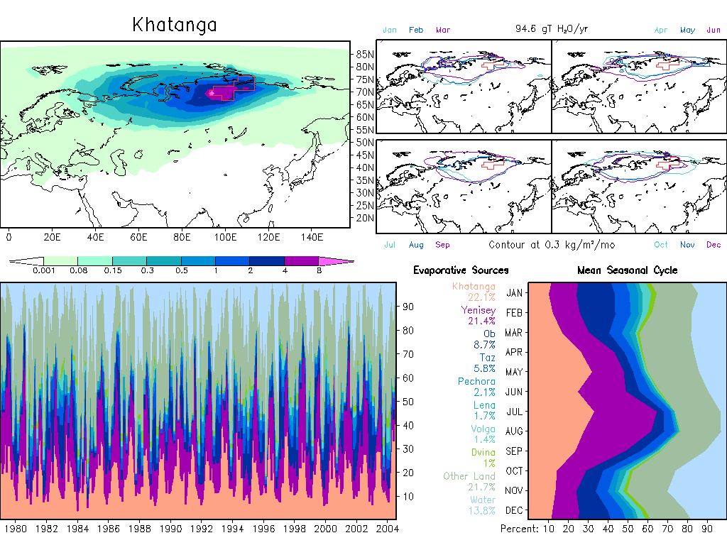
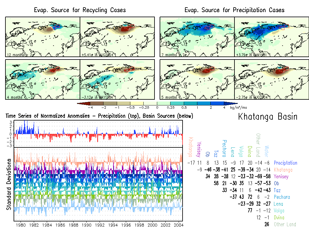
Khatanga: Climate, Anomalies.
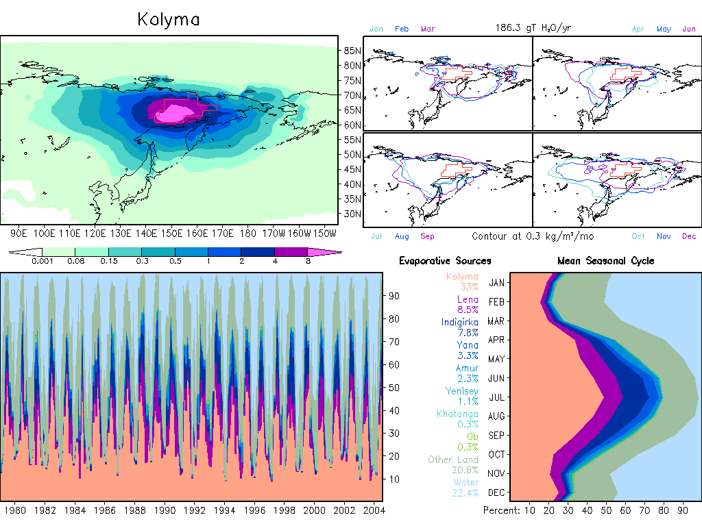
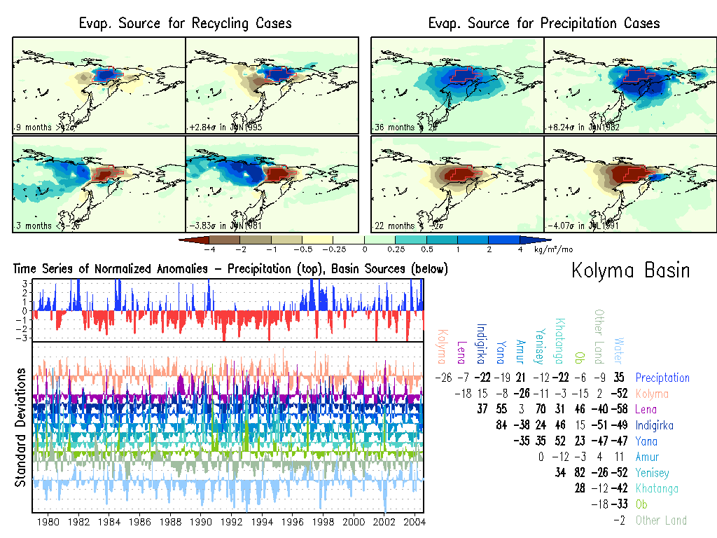
Kolyma: Climate, Anomalies.
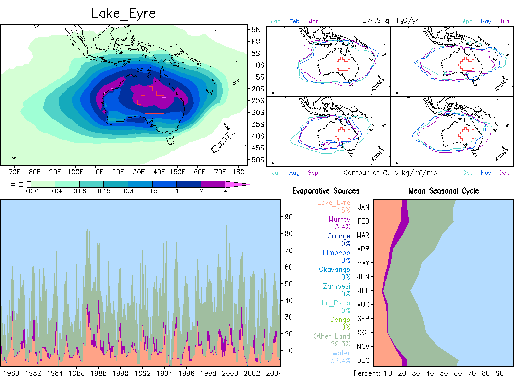
Lake_Eyre: Climate, Anomalies.
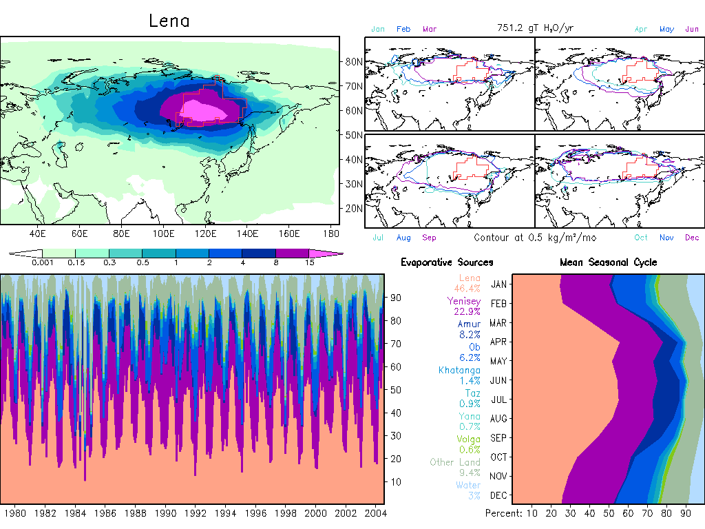
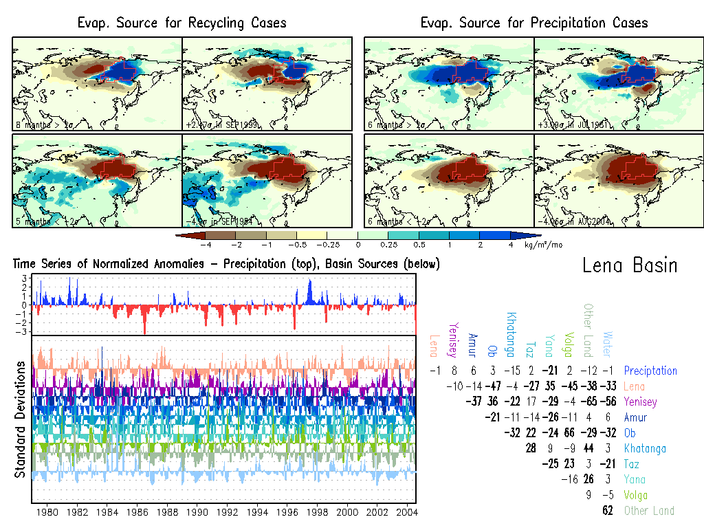
Lena: Climate, Anomalies.
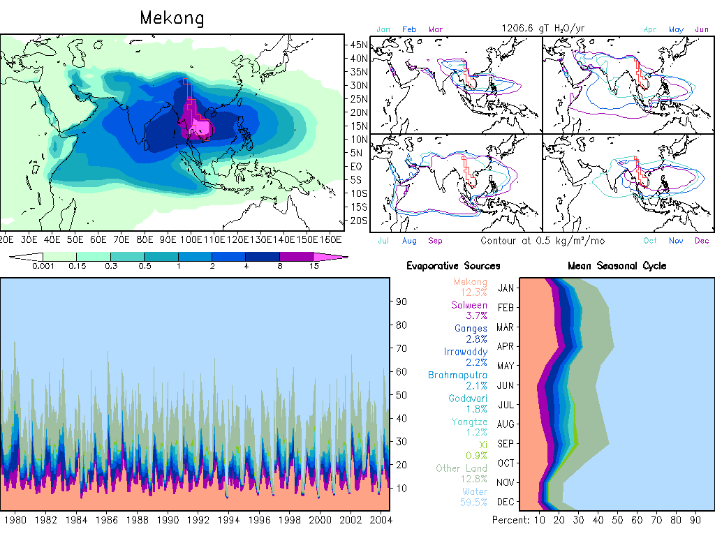
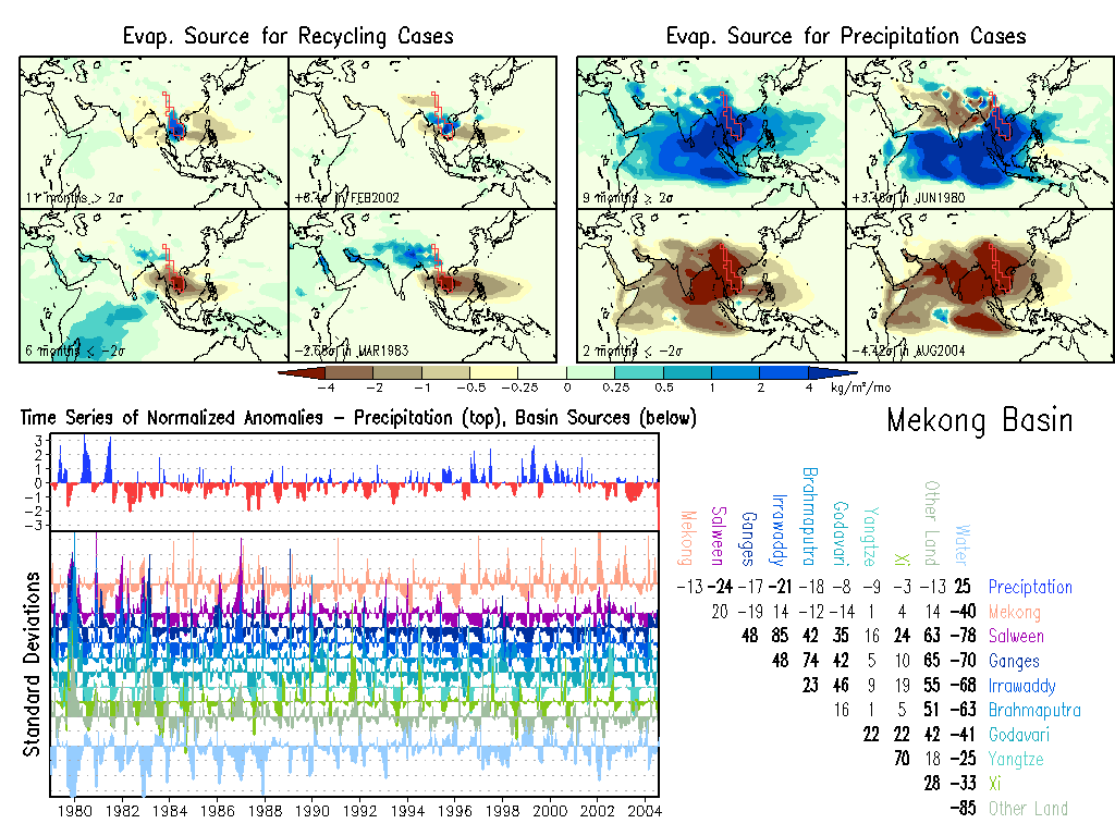
Mekong: Climate, Anomalies.
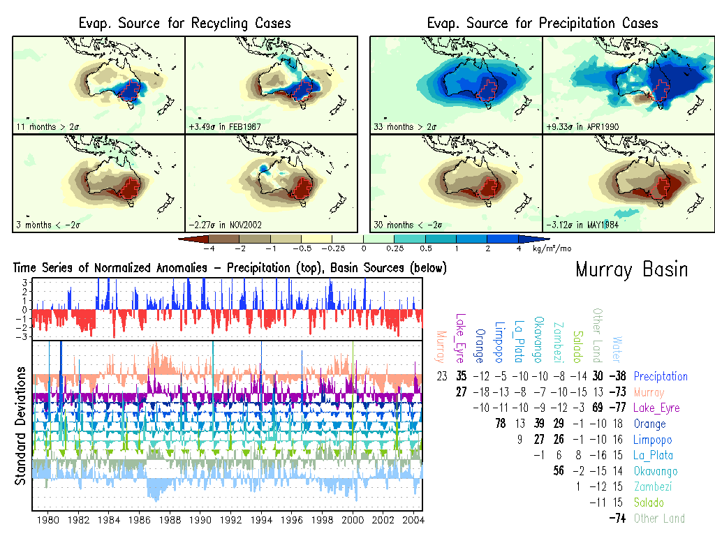
Murray: Climate, Anomalies.
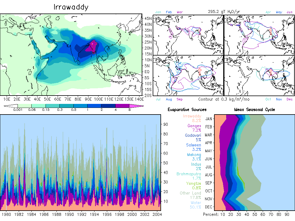
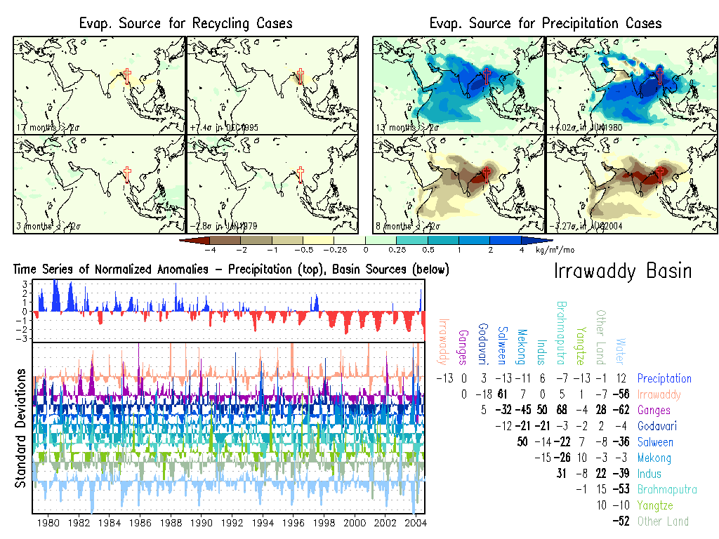
Irrawaddy: Climate, Anomalies.
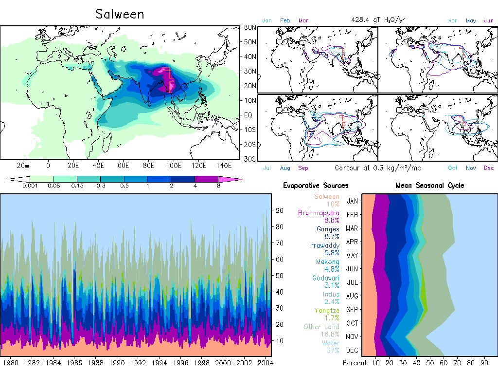
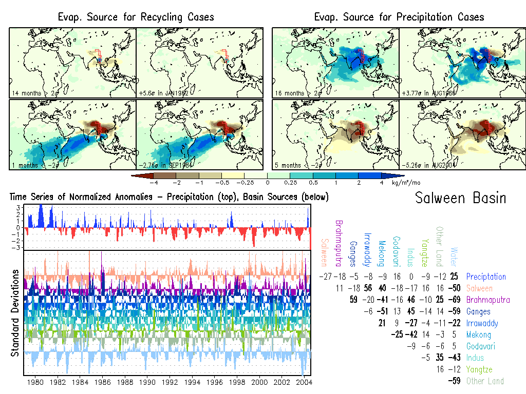
Salween: Climate, Anomalies.
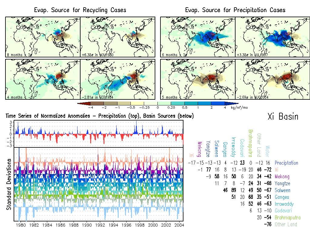
Xi: Climate, Anomalies.
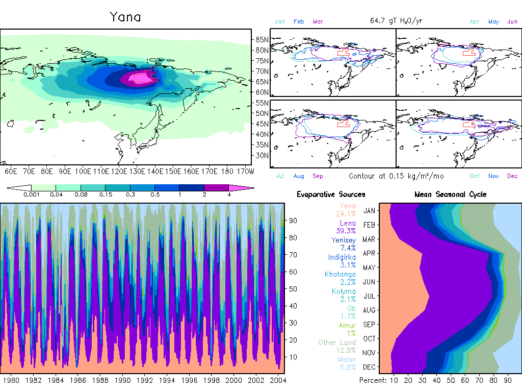
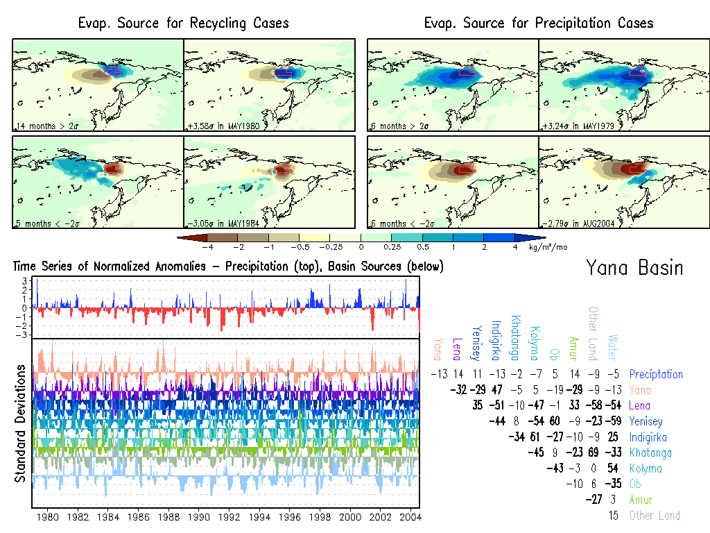
Yana: Climate, Anomalies.
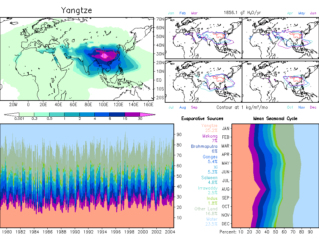
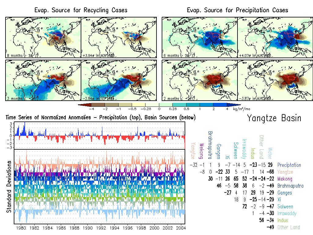
Yangtze: Climate, Anomalies. |
|
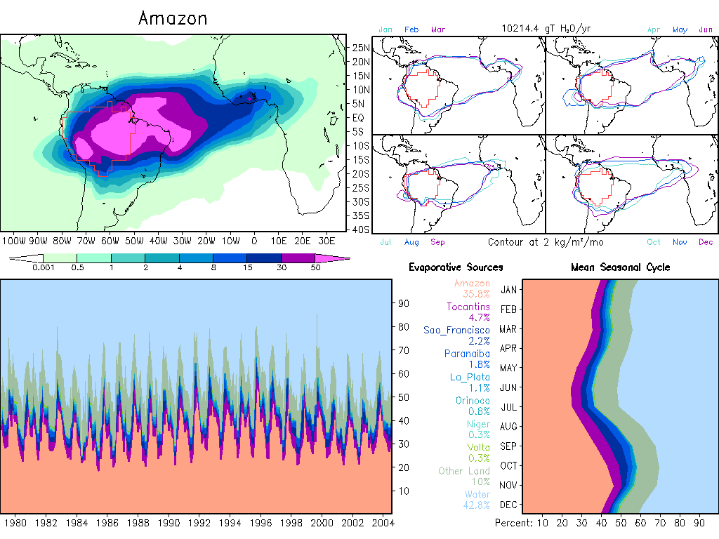
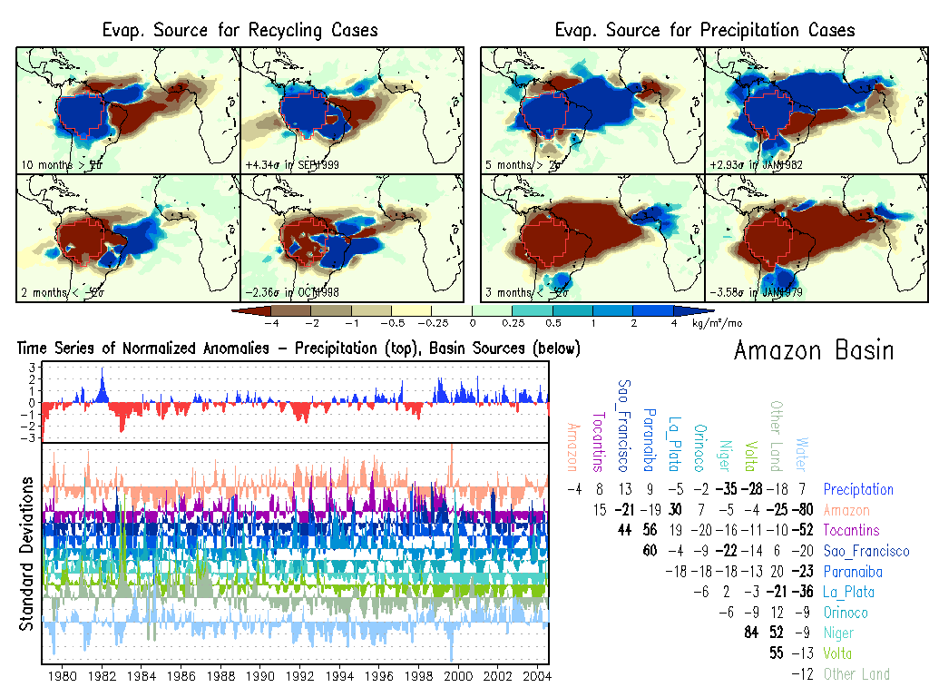
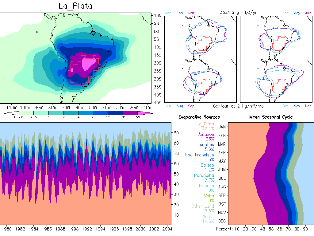
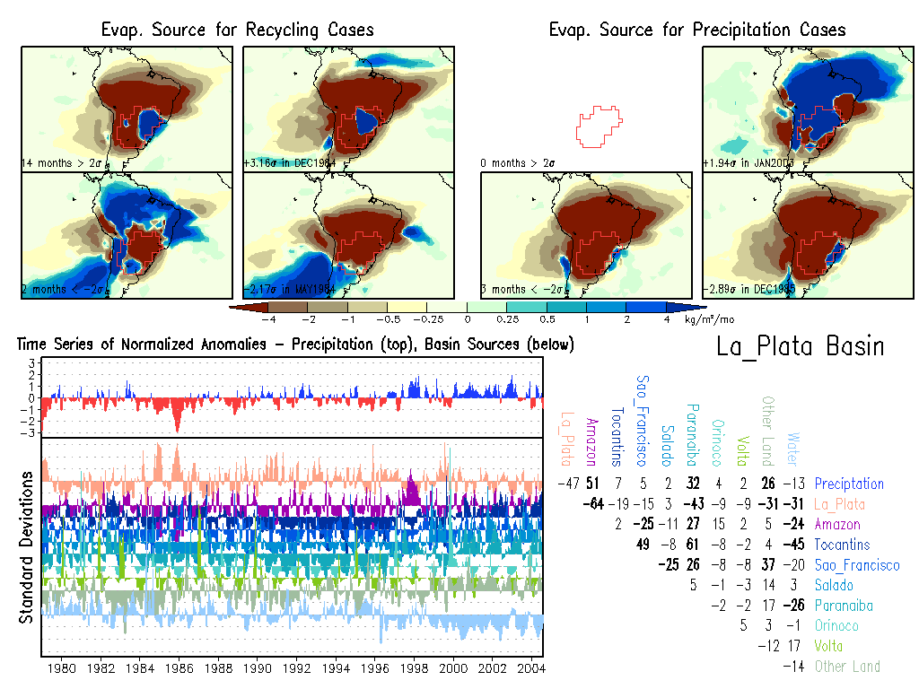
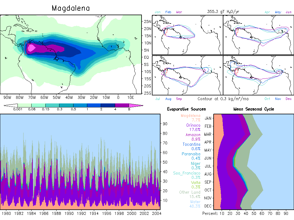
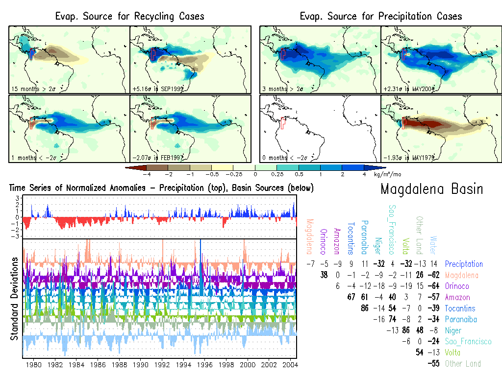
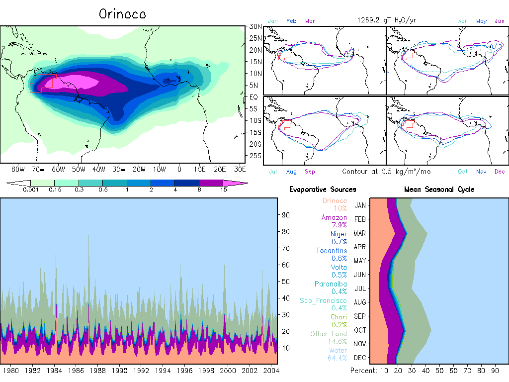
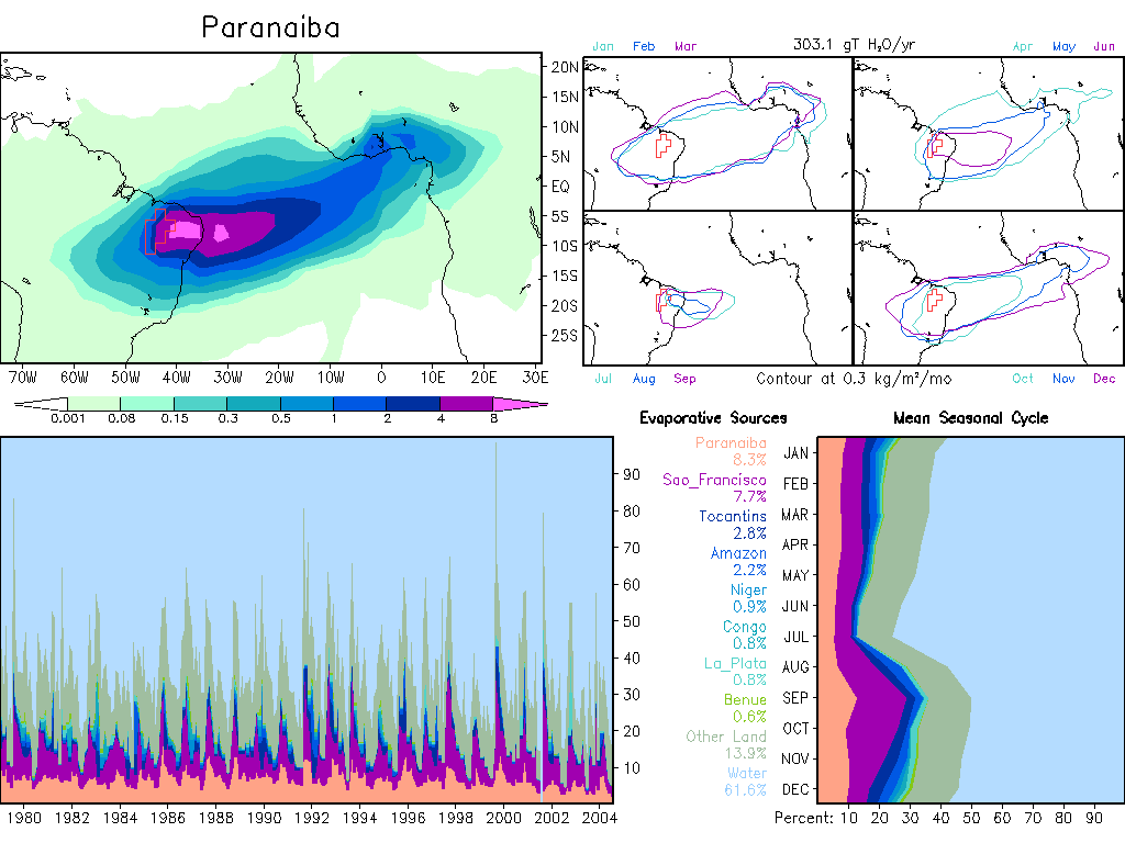
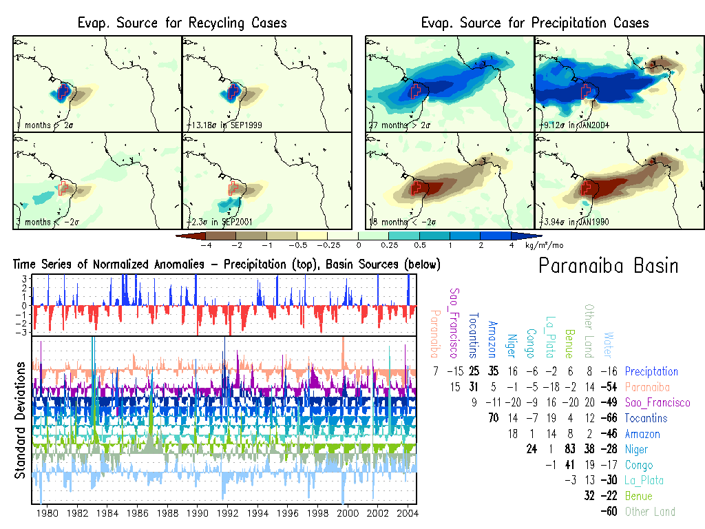
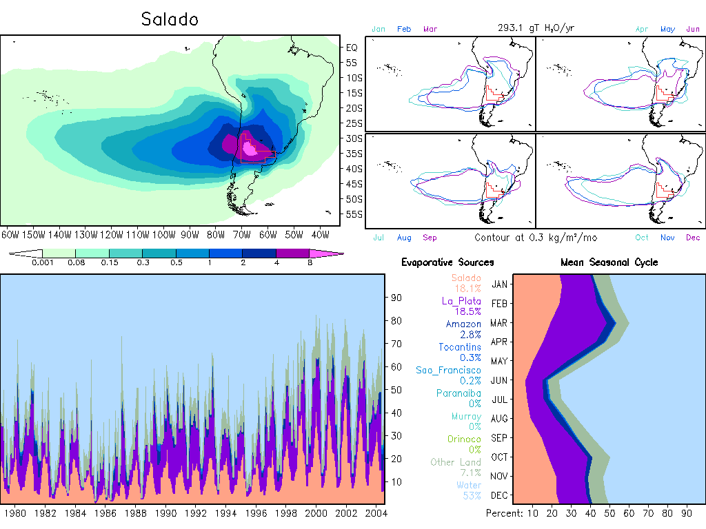
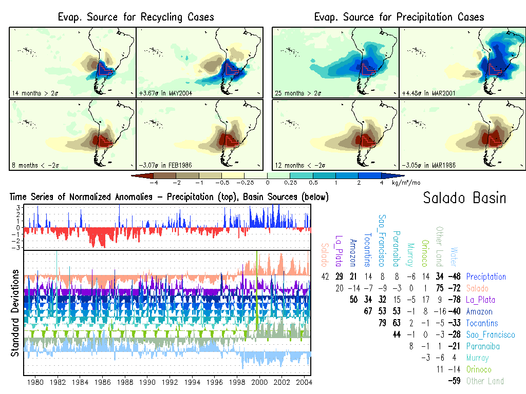
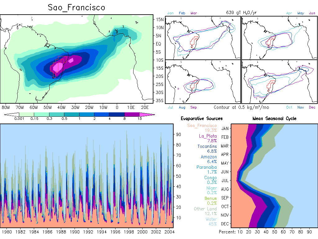
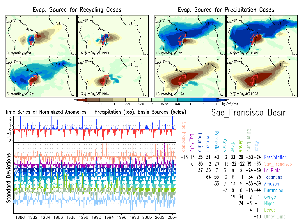
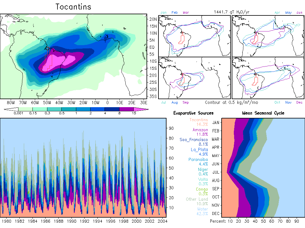
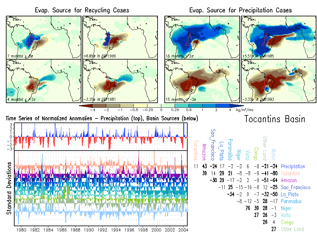
| South America |
Africa
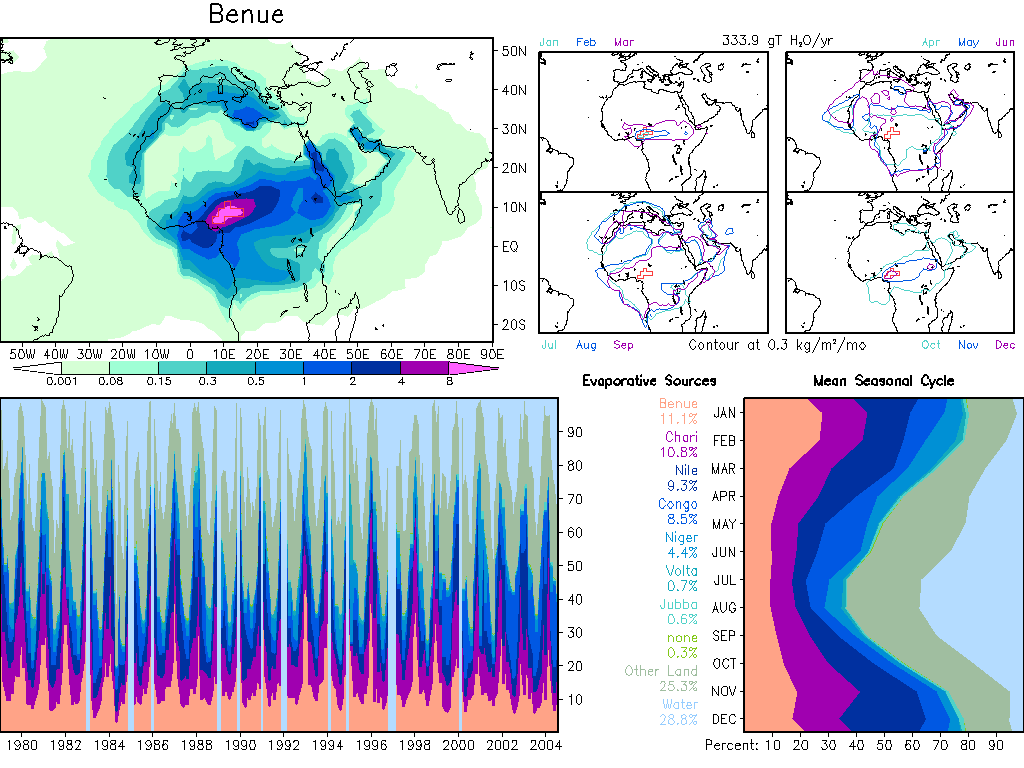
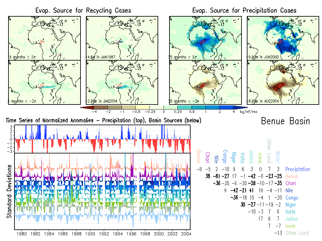
Benue: Climate, Anomalies.
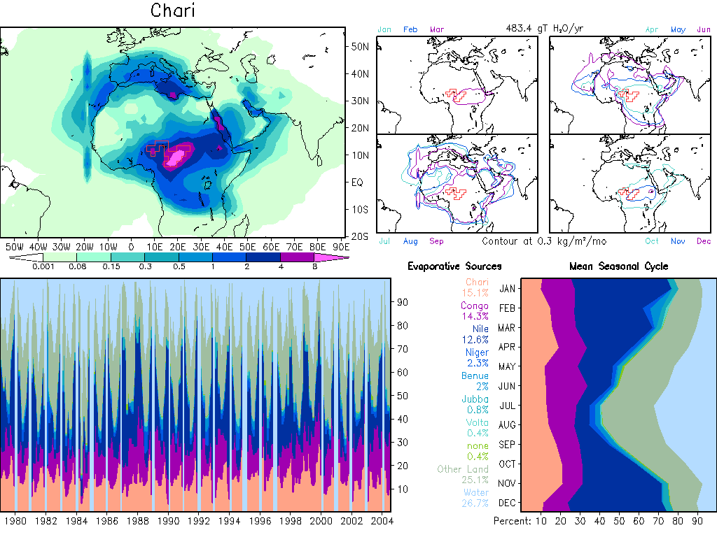
Chari: Climate, Anomalies.
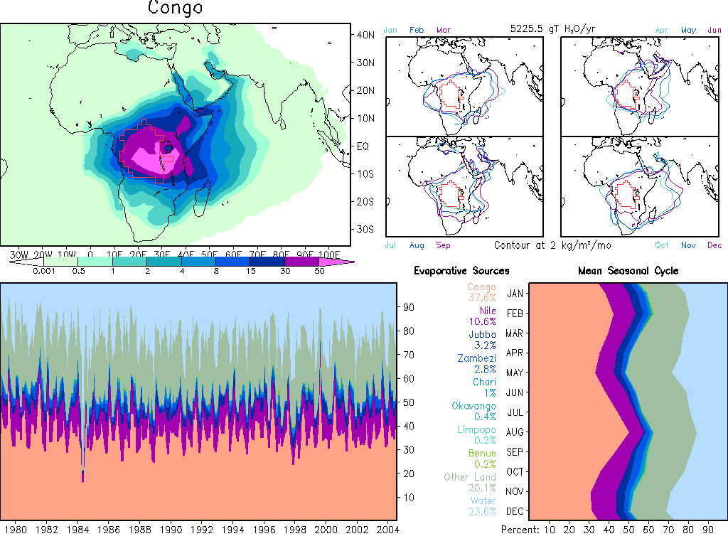
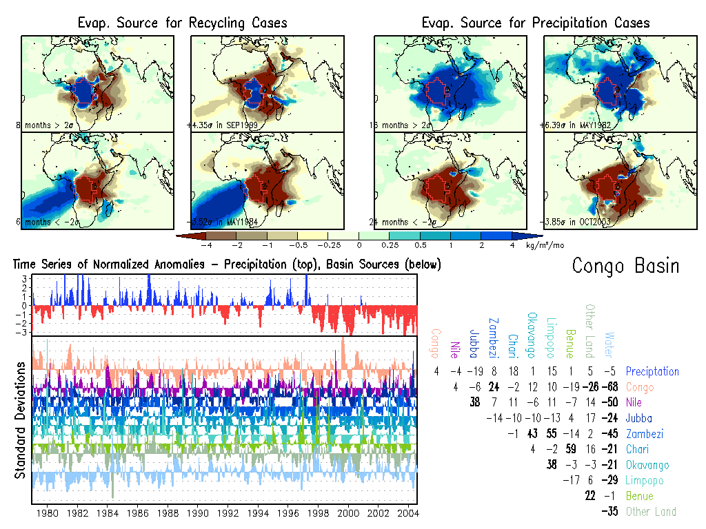
Congo: Climate, Anomalies.
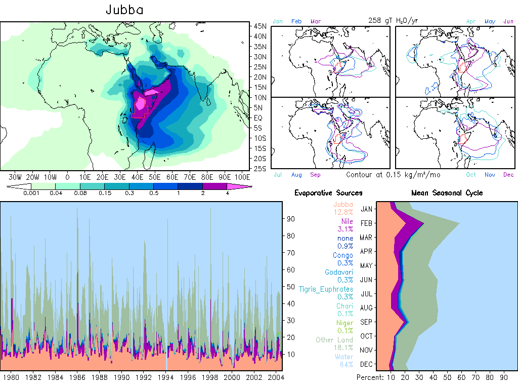
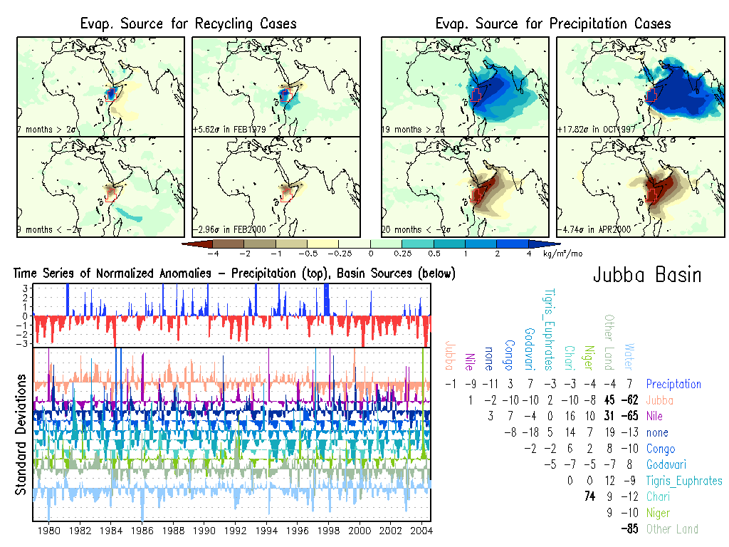
Jubba: Climate, Anomalies.
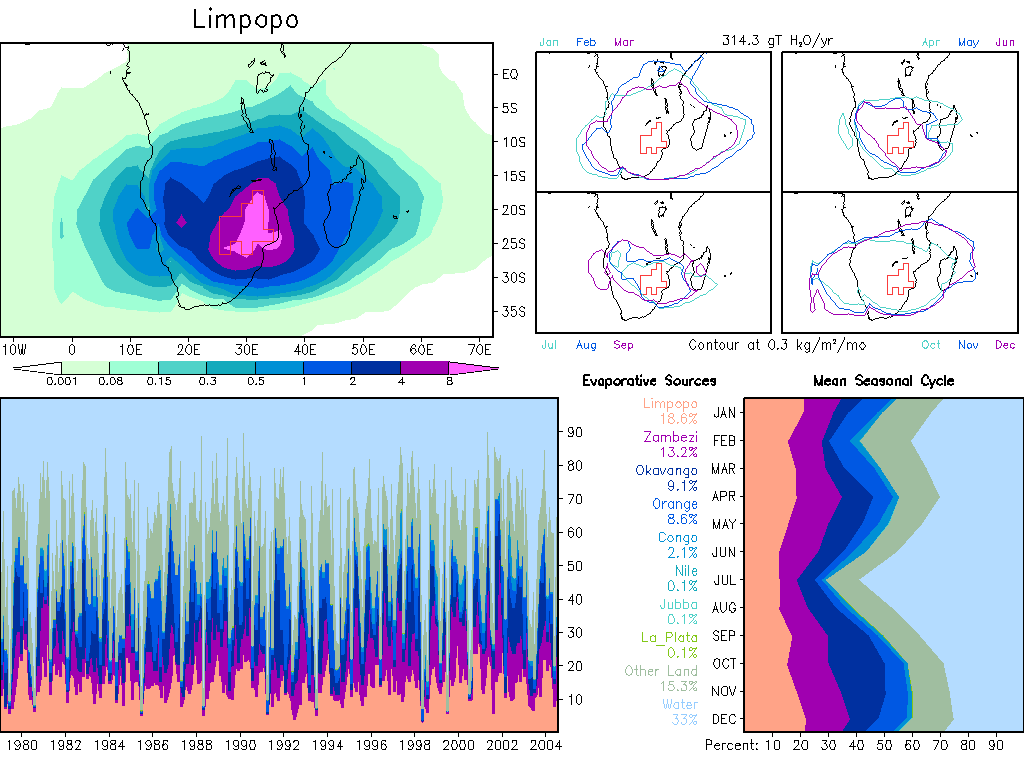
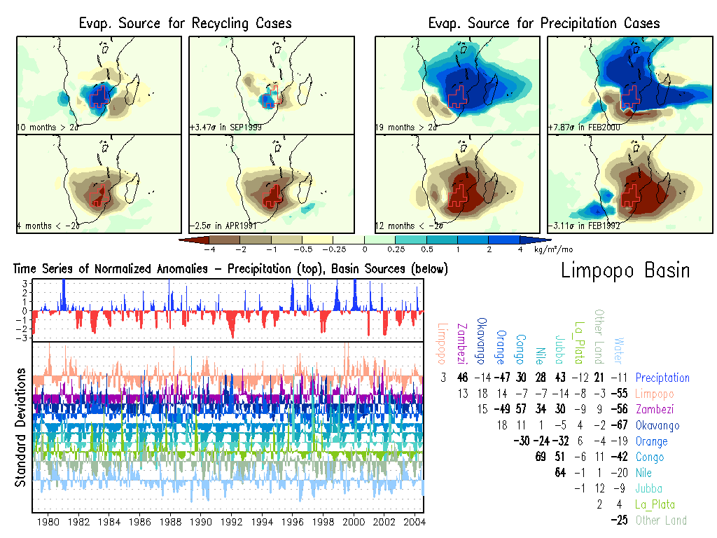
Limpopo: Climate, Anomalies.
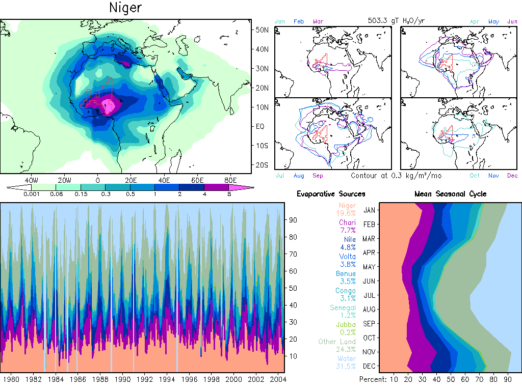
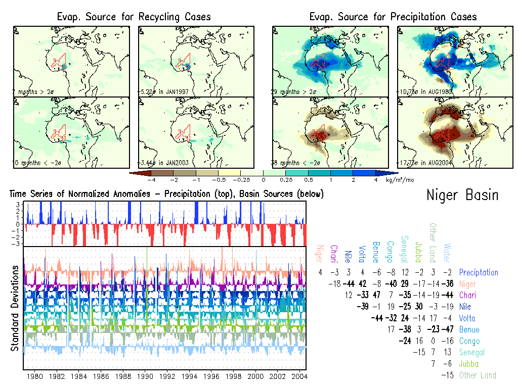
Niger: Climate, Anomalies.
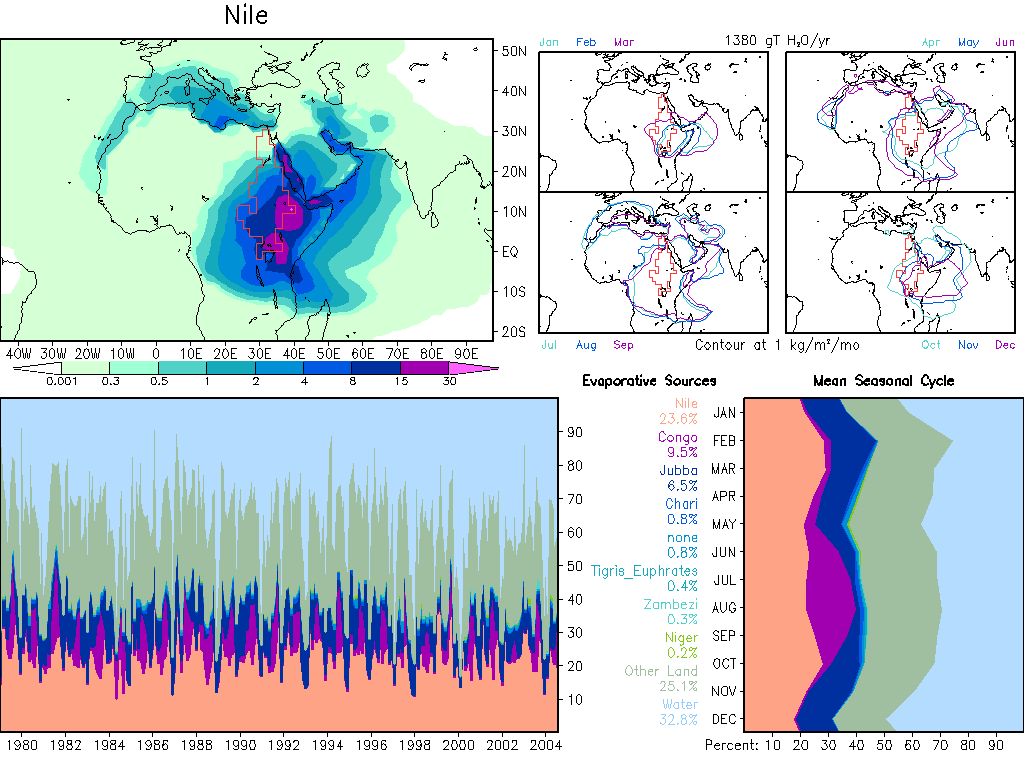
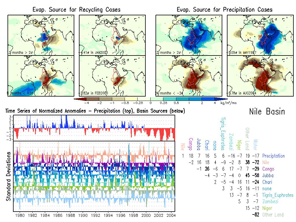
Nile: Climate, Anomalies.
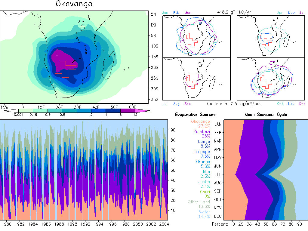
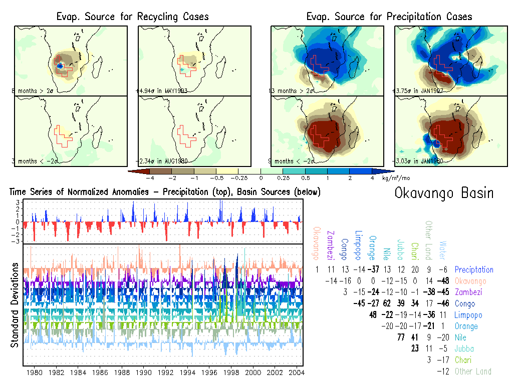
Okavango: Climate, Anomalies.
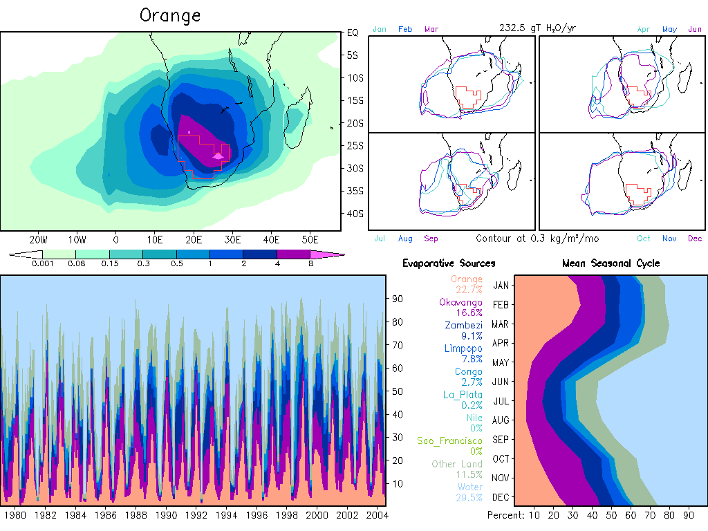
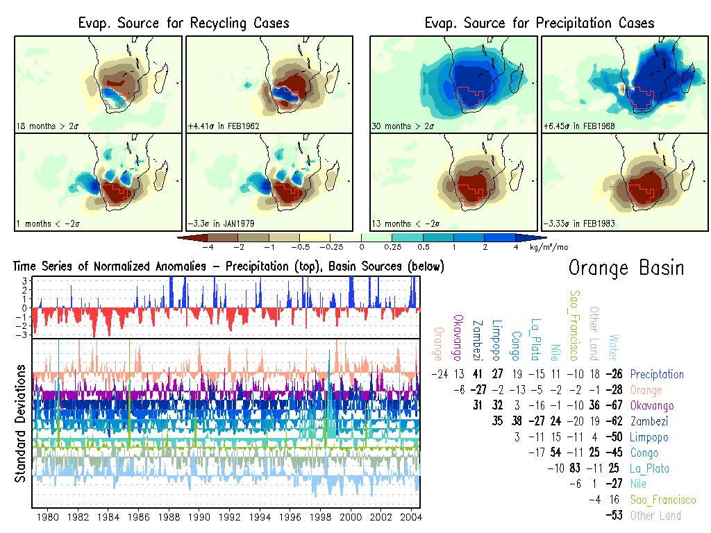
Orange: Climate, Anomalies.
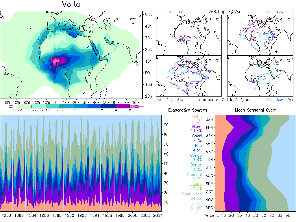
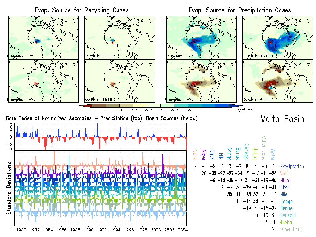
Volta: Climate, Anomalies.
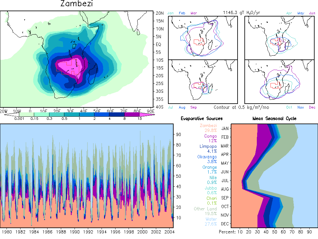
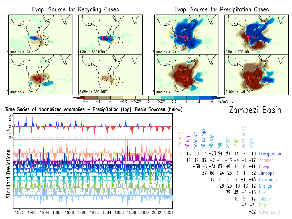
Zambezi: Climate, Anomalies. |
|